Arizona Trail Trip Report
Peter BetBasoo
March 23 to May 4, 2019
380 Miles
Thursday, March 28, 2019 -- Patagonia, Arizona
I started my hike of the AZT on at 8:30 AM on Saturday, March 23. On Tuesday, March 26 I arrived in Patagonia, finishing the first three passages, 52 miles, in 4 days, one half day ahead of schedule.
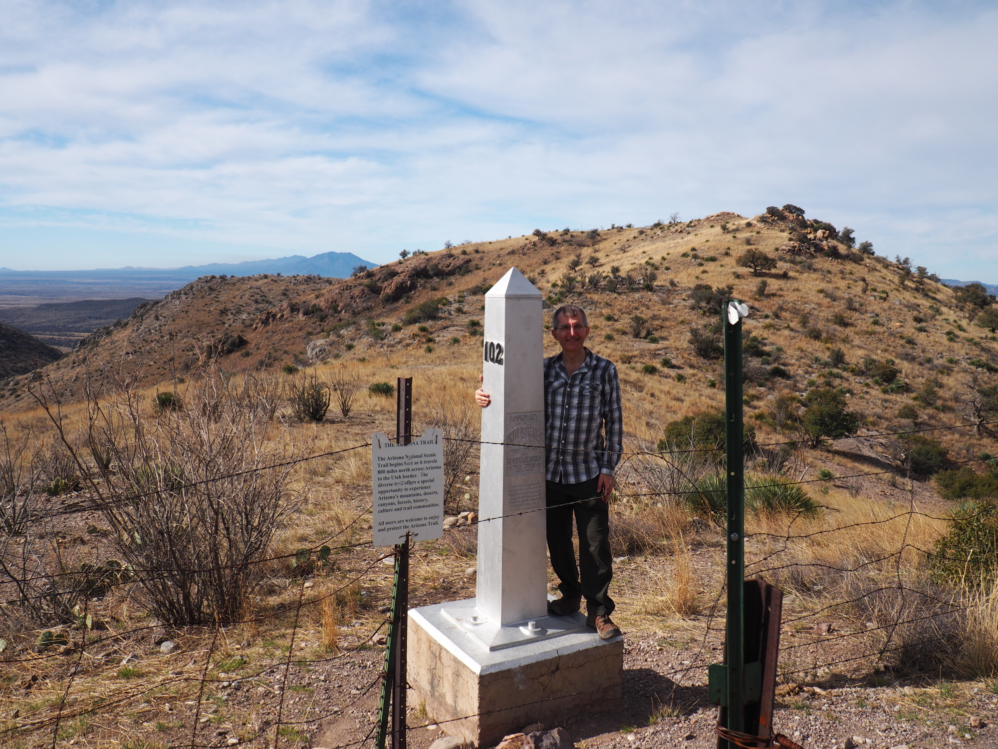
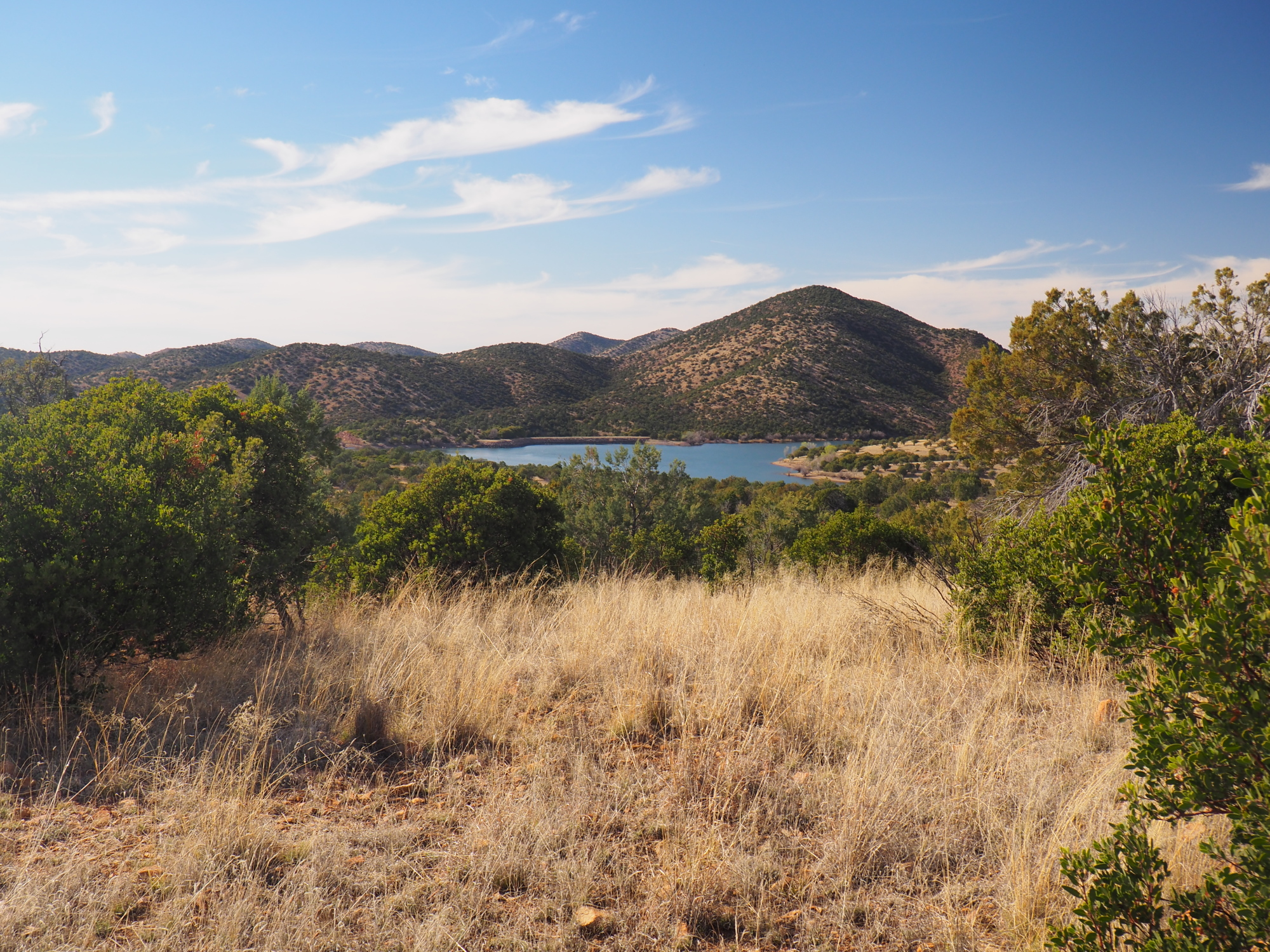
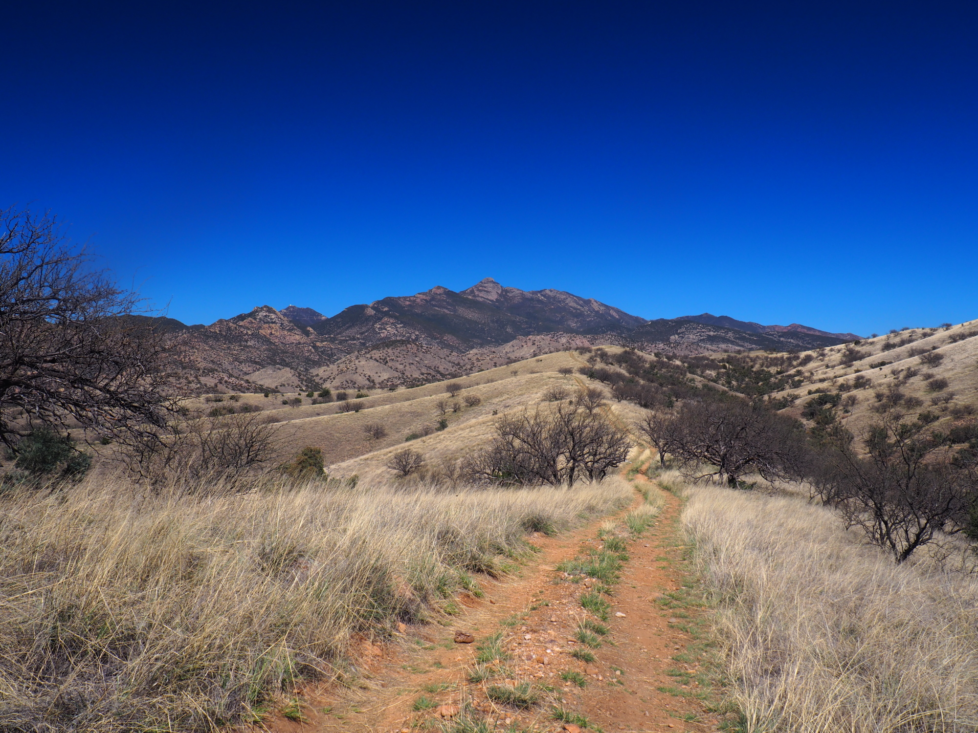
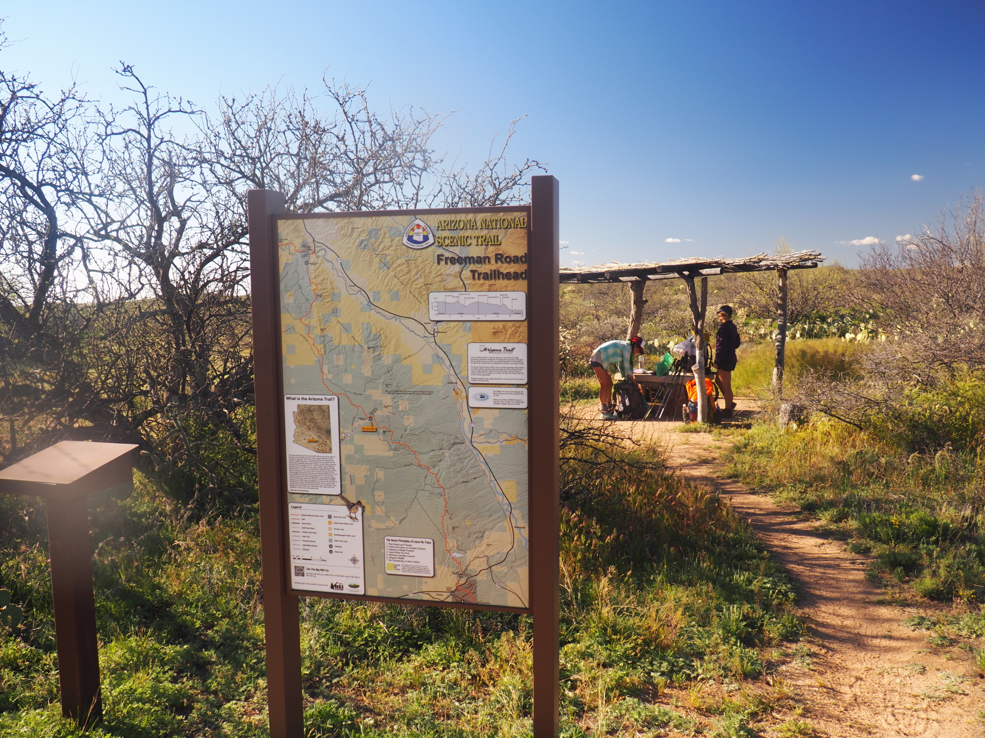
The AZT begins on passage 1, Huachuca Mountains, at the border of Mexico. To reach the southern terminus you must hike down 1.5 miles on the AZT, starting at Montezuma Pass. On my way down I met a couple who were doing the first two passages only. Half way back up I met Klaus, from Michigan, as he was coming down. He is hiking the entire trail. He is about 62 years old.
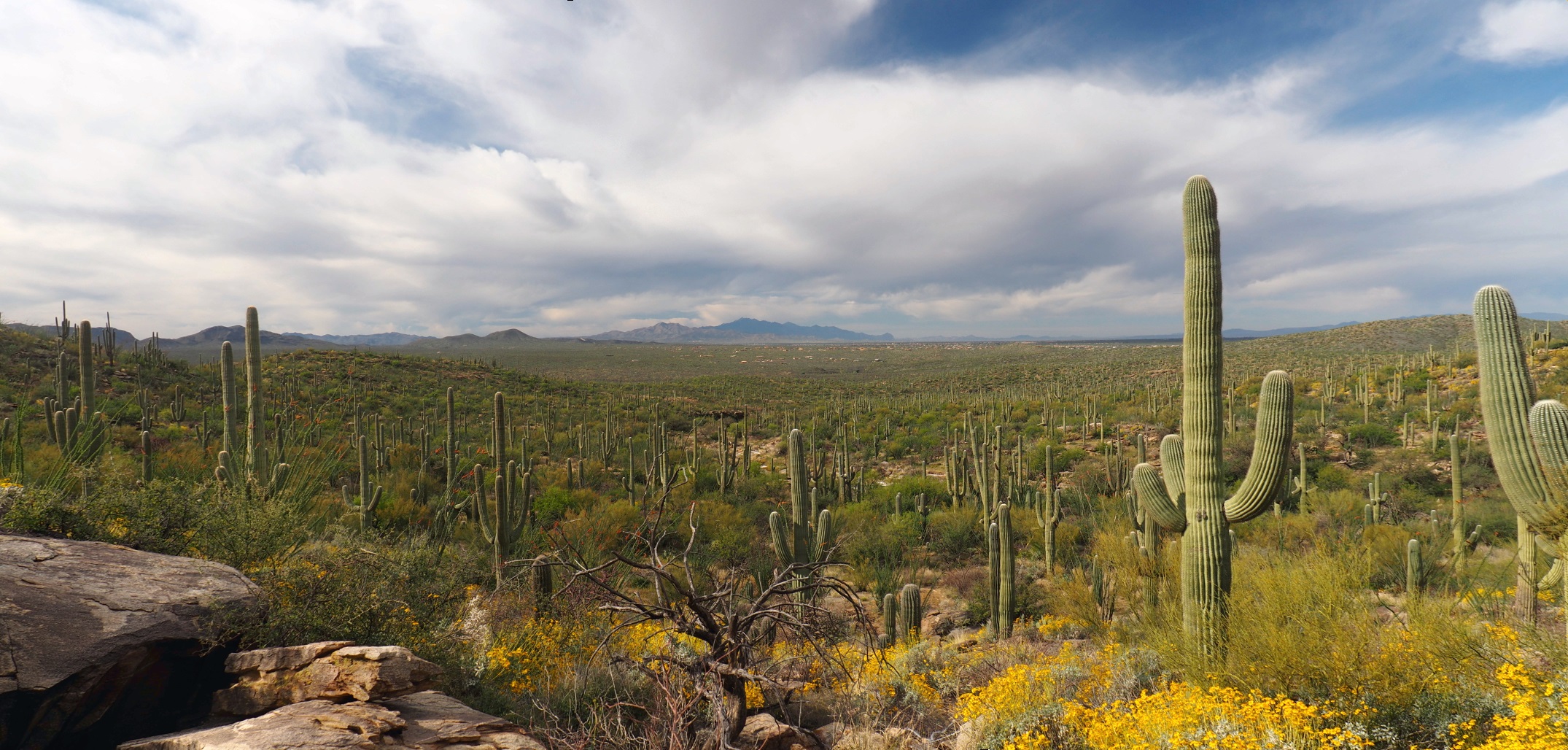
The views into Mexico while hiking to the border are magnificent. I reached the border in about 40 minutes. I spent a few minutes with the couple there, we photographed each other then I started to hike up.
I spent about 20 minutes at Montezuma Pass then resumed the hike.
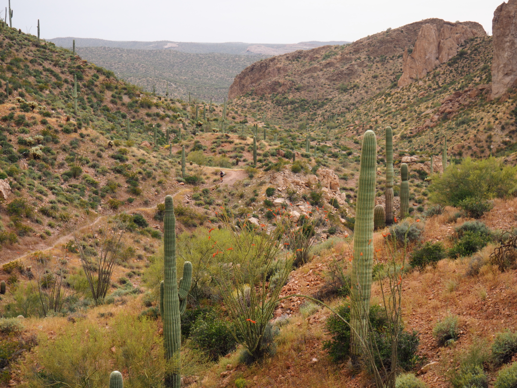
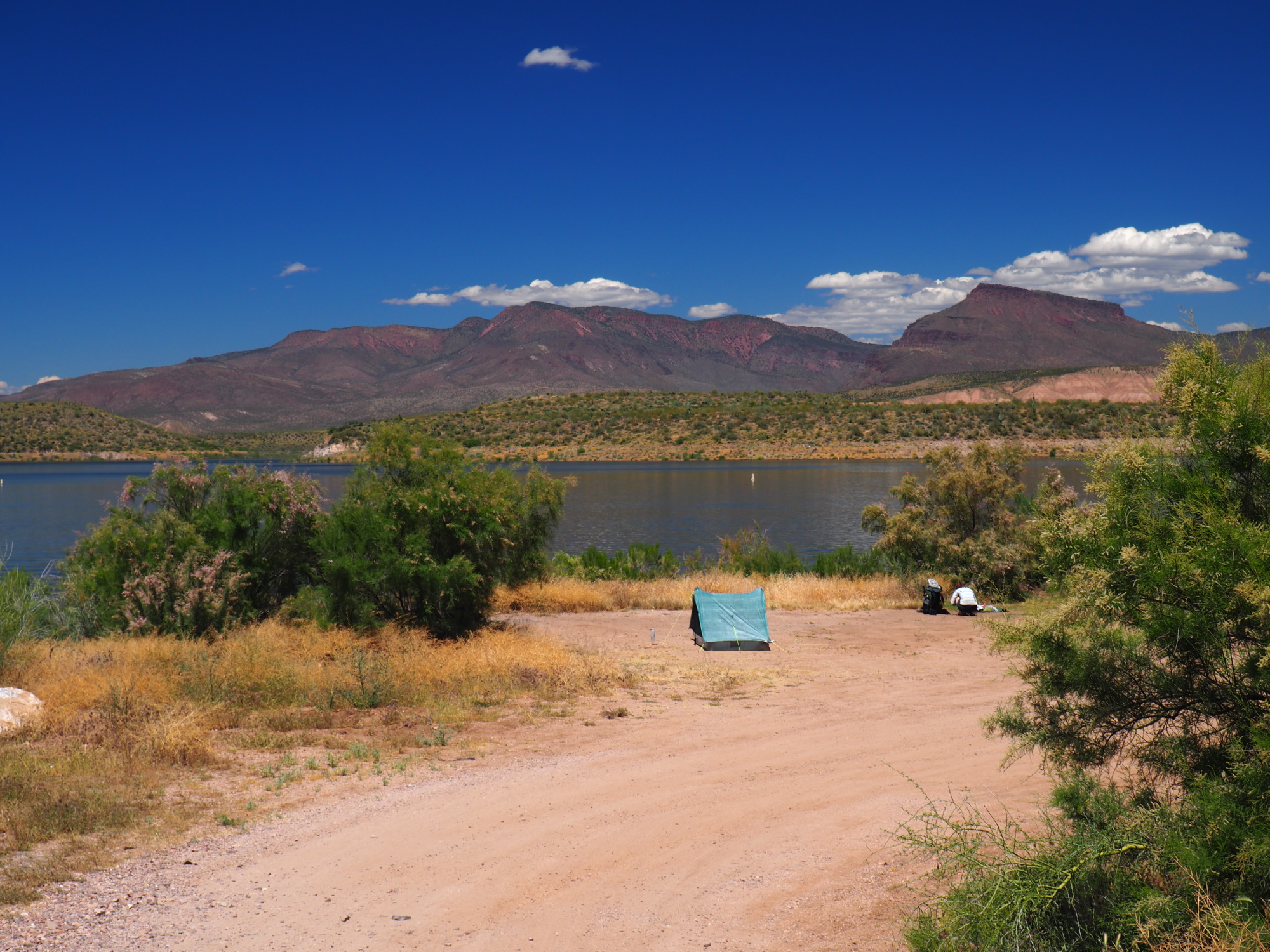
The AZT starts out with a bang! There is a 3000 foot climb over 8 miles from the border to Bathtub Spring, a reliable spring with a pipe that flows into a bathtub. The climb was murder. I stopped around 12:30 and made lunch with my wood burning stove. As I was gathering wood I had a feeling that perhaps a wood burning stove was not the best idea. More on that later. I spend about 40 minutes on lunch break.
I pushed on, and around 3 PM Klaus caught up with me and we continued on. We reached Bathtub Spring at 4:50. There was a lady camped there. We chatted with her and she informed us that she had sprained her ankle. I asked her if she needed an ACE bandage, she said she had that and was alright.
I filtered 3 liters of water from Bathtub Spring and then continued on, with Klaus, our destination being 1.5 miles away, called Bear Saddle, where we would camp for the night.
In retrospect it was not a good site. It was extremely windy, with gusts up to 20 miles per hour, and the ground was not flat and a bit rocky. I am using the Guthook's app and I should have checked the comments left by other hikers, because only .6 miles up there was a nice and flat area shielded from the winds.
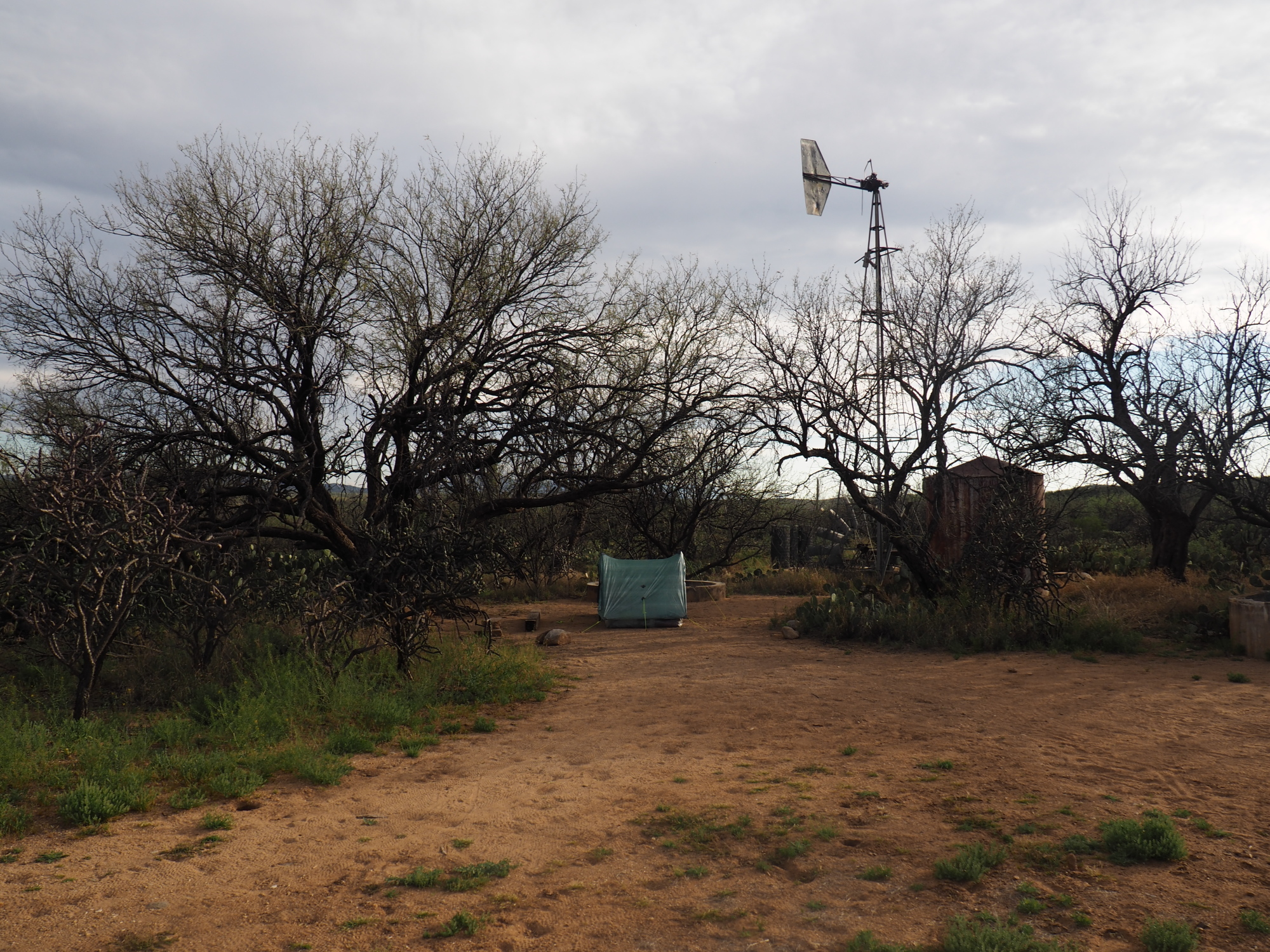
Bear Saddle is also a well-known site for illegal immigrants.
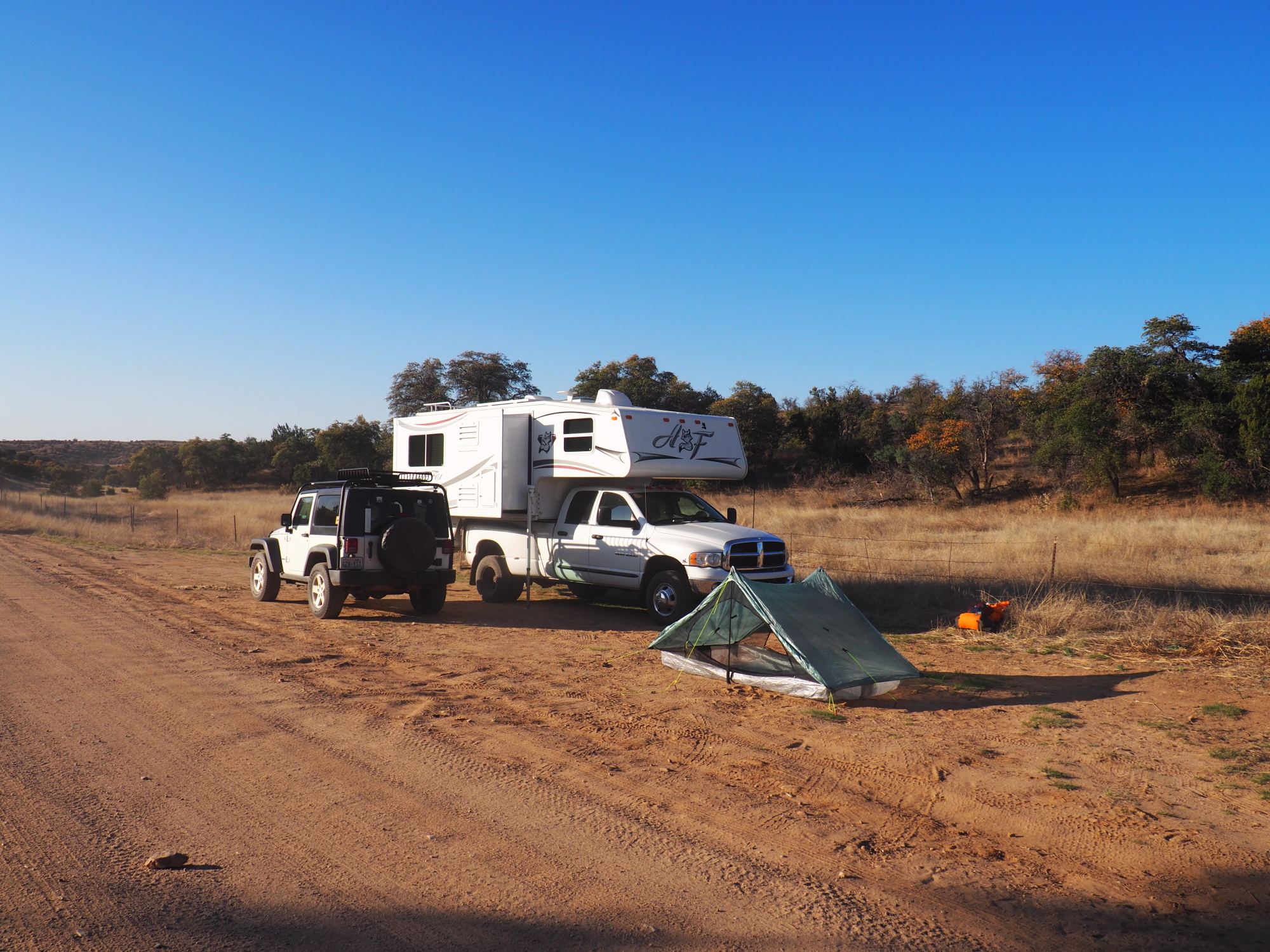
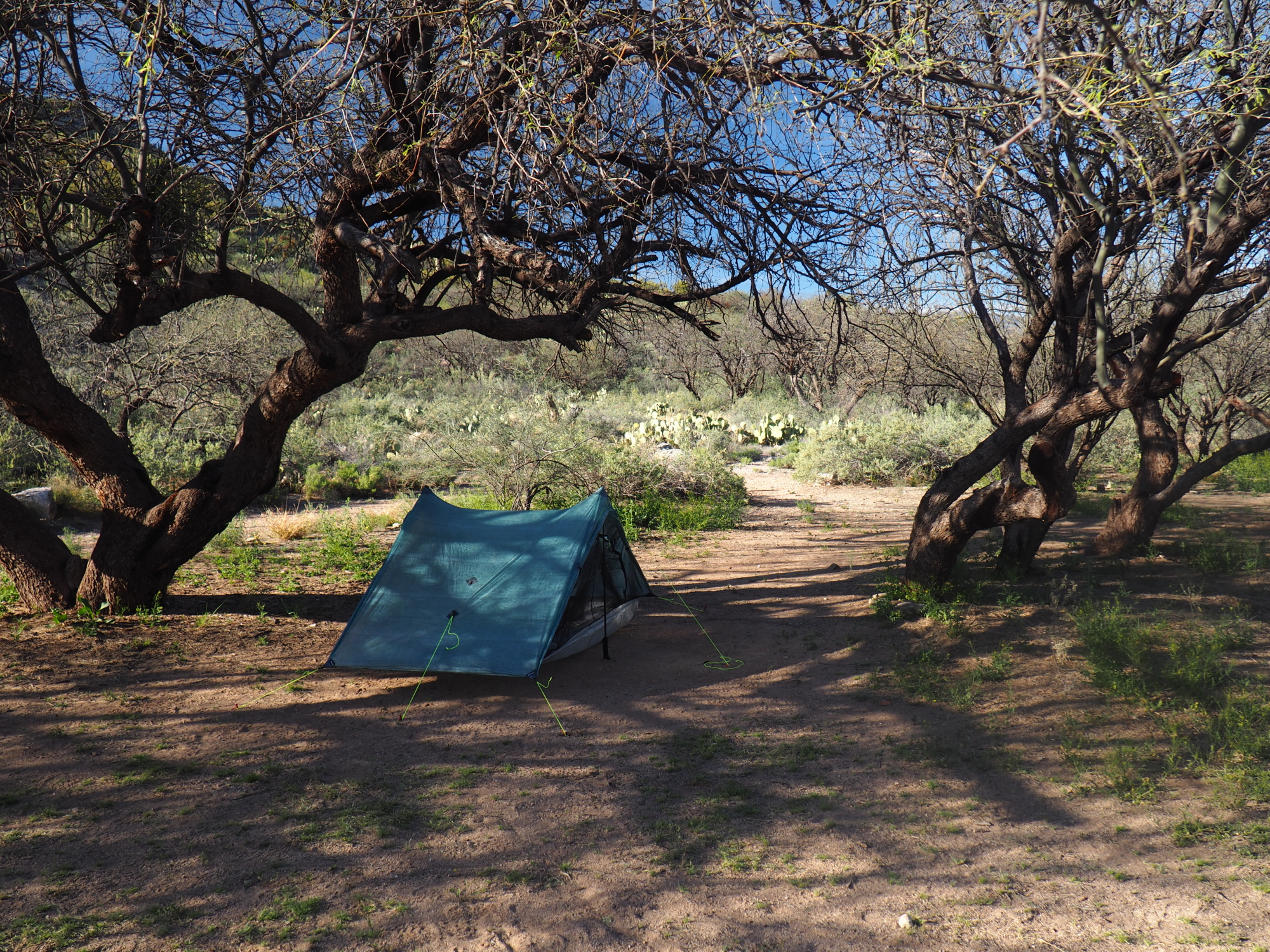
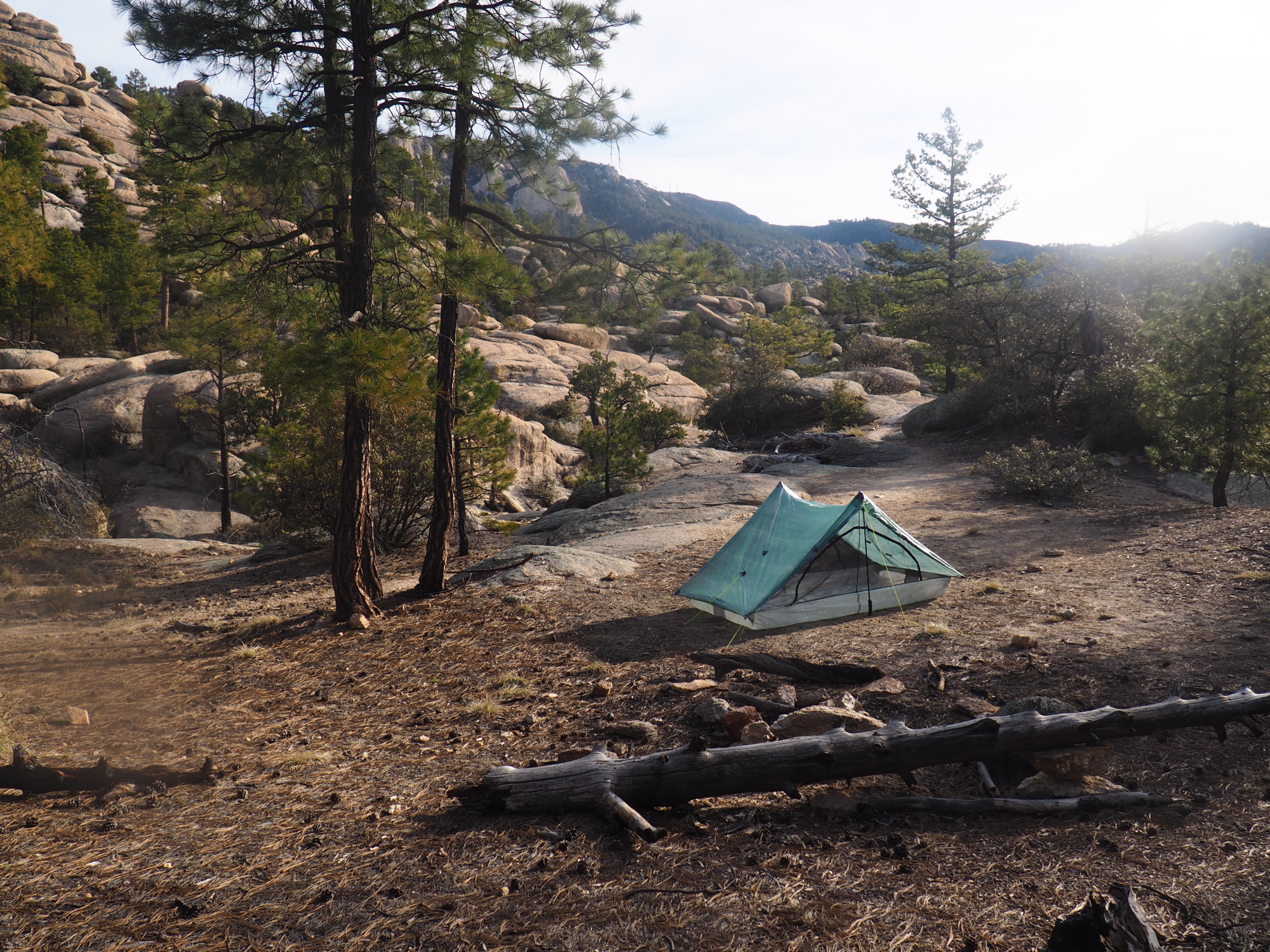
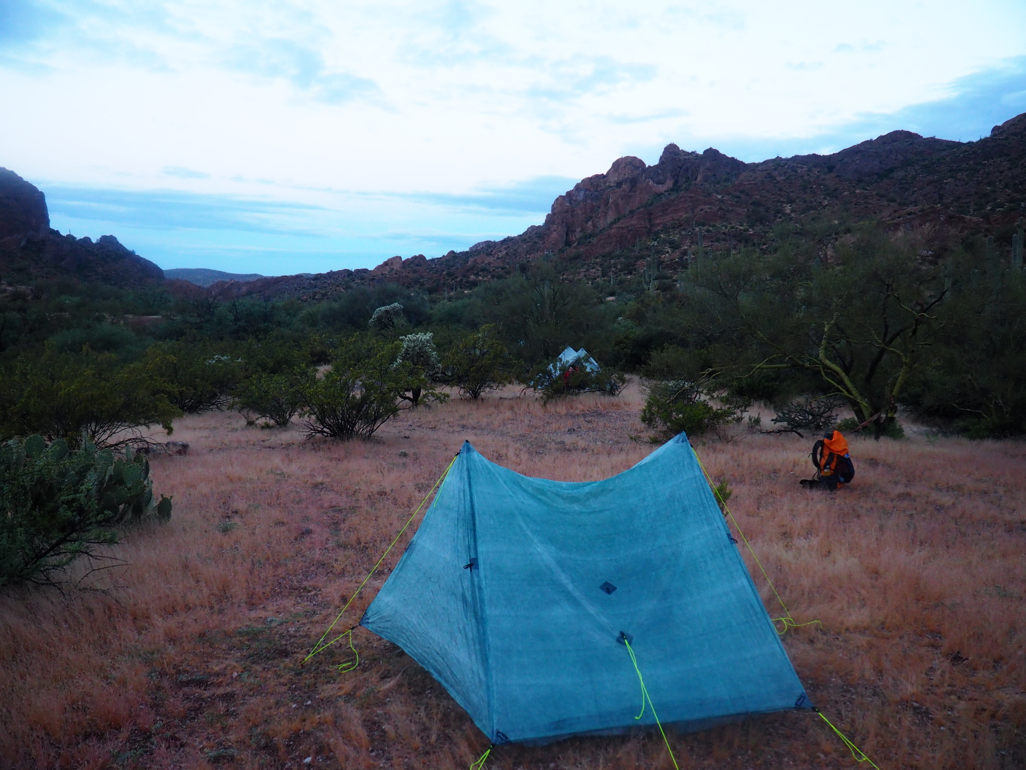
I setup my ZPacks Plexamid V tent on a slight incline, the best spot I could find. Then I started dinner. I gathered wood and had the fire going in about ten minutes. As Klaus and I were cooking our dinners we were visited by two border agents, who were patrolling the area. They were in uniform and armed with machine guns. They were very nice, and one of them was very curious about the AZT and impressed that we were doing it. Their base is 5 miles down the mountain. I thought to myself what a terrific job! You get to hike in the Miller Peak Wilderness and get paid for it.
We both ate our dinners and then went to sleep, but it was not good sleep. The wind was fierce and it was cold. I had all the clothes that I had brought with me on and it was barely warm enough. And the wind got stronger. Around 4 AM it was gusting at nearly 30 miles per hour.
Sunday, March 24
I woke up around 6:30. Klaus was already up and packed. He said he had a miserable night and did not sleep well. So he woke up early and packed. He left at 6:45.
I started to gather wood to cook breakfast. It was a little tricky starting the fire because the dead wood was slightly damp from the morning dew. I got it going, but I began to regret choosing the wood option.
I ate breakfast and hit the trail around 7:45.
It was mostly downhill to the end of the first passage. There was snow on the northern slopes, and a good 1.5 mile portion of the trail was under snow.
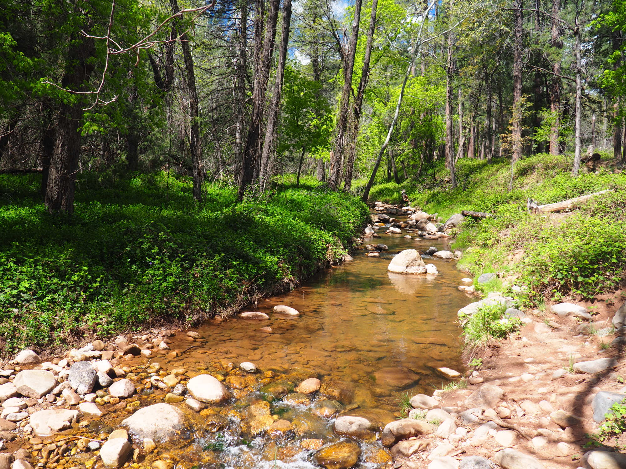
There was plenty of water as it has been a wet year.
I made it to the end of passage 1 at 4 PM. It is one mile from Parker Canyon Lake. I started passage 2, continuing on to Parker Canyon Creek, 2 miles ahead, where there are beautiful campsites next to the Creek. I setup camp there.
I filtered 2 liters of water, while doing that I noticed a pinhole leak in my Katadyn BeFree. It was only noticeable if I squeezed when filtering, which would cause a thin spout of water to come out. I would have to swap this out. It seemed alright for the time being.
I gathered wood and cooked dinner, then popped a melatonin and went to sleep at 8. I slept very well for about 6 hours and then it got very cold. I couldn't understand why, because the forecast was for a low of 40. I stuck my hand out of my tent around 2 AM and felt it was warmer outside than in the tent. Then I noticed the condensation in the tent. It was very bad. Even the top of my quilt was moist. No wonder it was colder inside the tent!
The Plexamid has only one mesh door, and it was not adequately ventilating the tent. This was not good!
Monday, March 25
I couldn't sleep very well for the rest of the night because of the dampness in the tent. I woke up at 7, cooked breakfast, all the while dreading the chore of gathering wood, then hit the trail at 8:15.
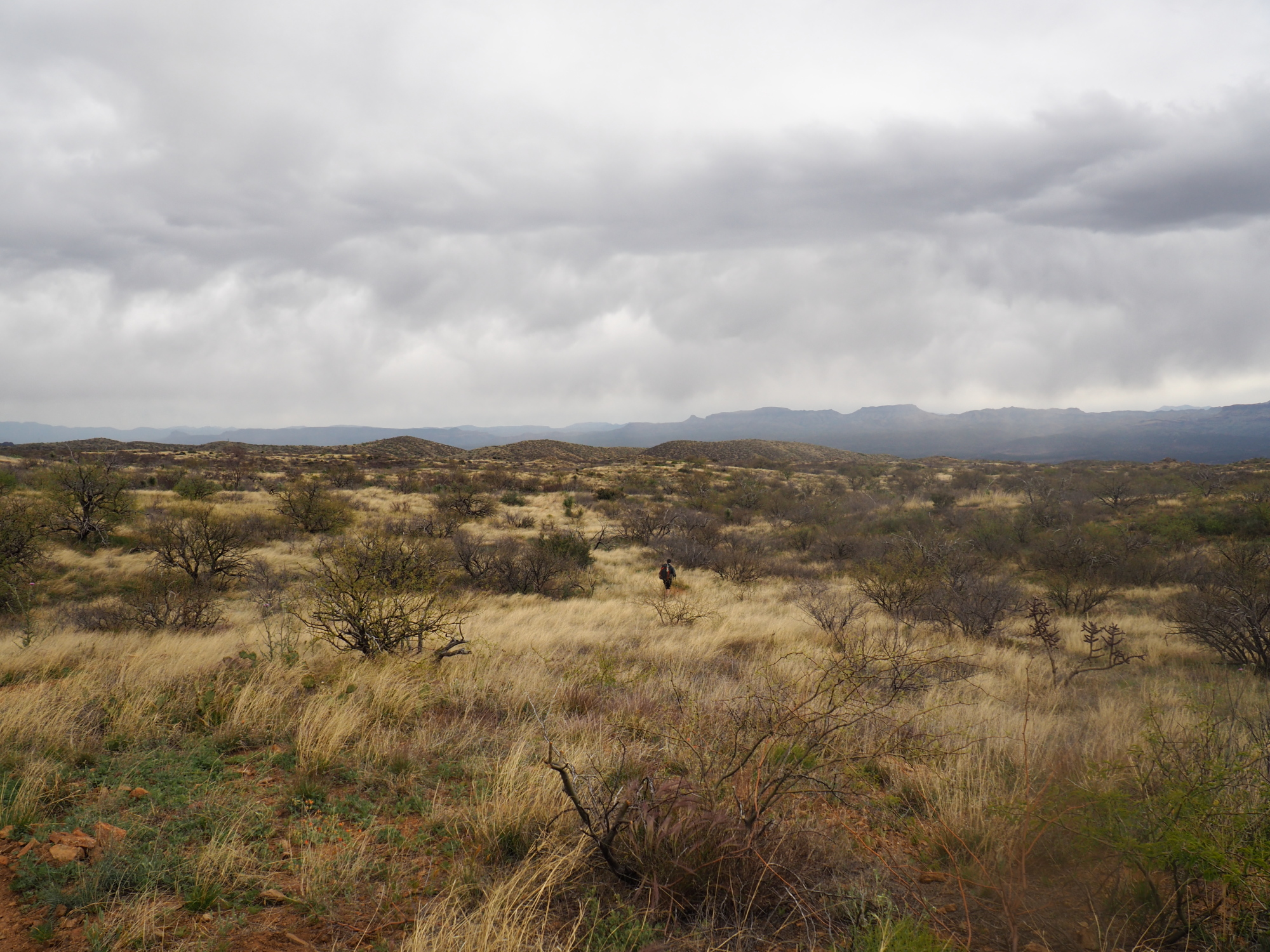
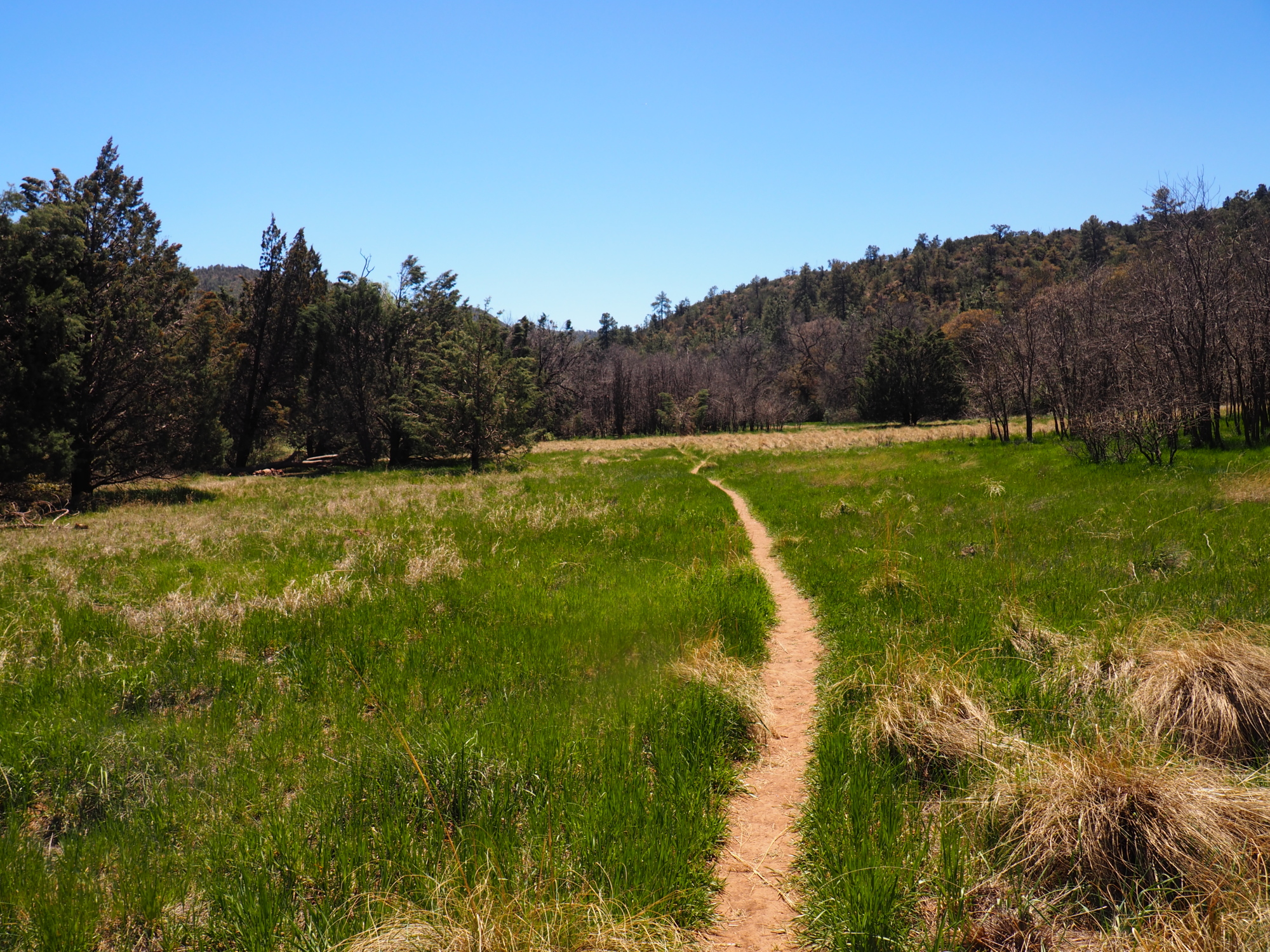
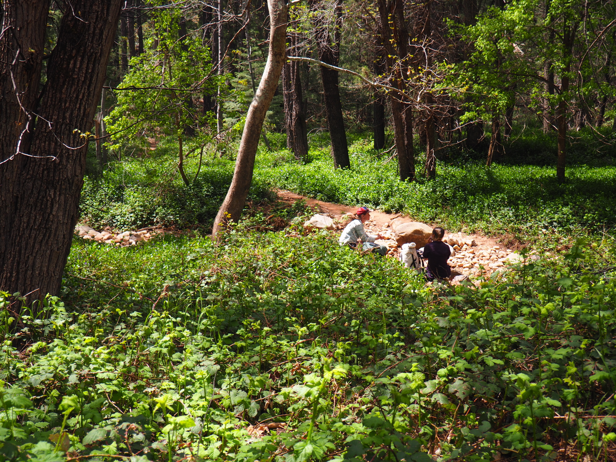
The second passage of the AZT, Canelo Hills East, is a series of hills stretching for 14 miles. There are no steep climbs, just small ascents and descents for the entire passage.
At about 9:30 I ran into two bicyclists from South Africa, who were just packing up. We chatted for a couple of minutes and they informed me they were riding to Patagonia. I told them they would soon pass me. But that never happened.
At 11:30 I met this very nice couple from New Hampshire, 70 years old, who were hiking a loop in this passage. Their names are -- I kid you not -- Tom Sawyer and Diane Sawyer. We chatted for about ten minutes. They told me they had thru-hiked the Appalachian Trail 3 years ago. Wow!
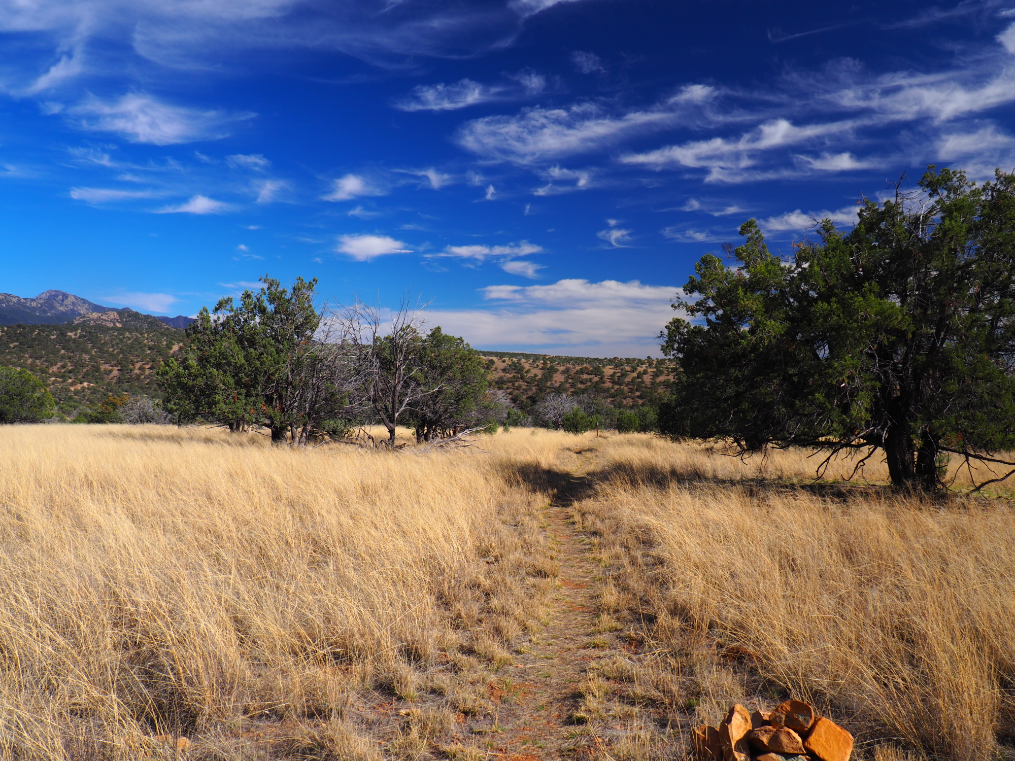
As I hiked over the Canelo Hills I asked myself why am I doing this? Why do people spend months walking? What purpose does it serve? Whom does it help? Does it feed the hungry? Does it find the next vaccine? It seemed to me to be a very selfish activity. Have the people who do these long hikes lost their purpose in life and are just trying to fill the void? I know that in the past two years I have lost interest in most things that I used to do, including dancing and teaching dancing, and activism for my people (Assyrians), which I was so heavily involved in. Isn't the purpose in life to help others? Which means to love others, love them unconditionally. Isn't it about love? So what good does thru-hiking do?
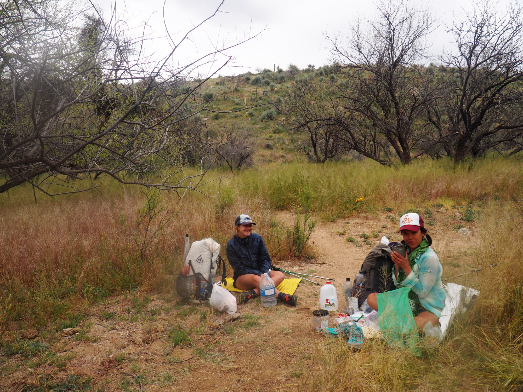
I continued on. Around 4 PM I stopped for a snack and water at a junction with another trail, and lo and behold Tom and Diane came up that trail. We chatted again and Diane told me they had run across the South Africans, and that one of them had wiped out and badly scraped his left arm, which was bandaged from wrist to shoulder.
We set out together to the trail head of the third passage and I arrived at 5:30 to an area .2 miles from the trail head, about 10 minutes before them. There were many pools of water in the creek next to the trail, and many flat areas for camping. I filtered 3 liters and continued to the trail head, where there are two camp sites.
I tried to pitch my tent but the ground was hard and I could not put my stakes fully into the ground. I broke the tip off one of them. I was tired and I thought about going ahead a little to find a better spot but then I checked myself. Only .2 miles behind me was water and many campsites, whereas before me was unknown. And it was late. So I walked back .2 miles and found a great site with soft ground. I was so tired I didn't want to bother looking for firewood, so I had a cold dinner.
But it was a miserable night because of the condensation in the tent. It was the worst so far. The Plexamid V was proving to be a failure. I woke up around 6:30 to find some dripping from the ceiling of the tent. The top of my quilt was very moist. So I quickly packed up, walked .2 miles up to the trail head and cooked breakfast there. At 7:45 I started on passage 3, Canelo Hills West.
Tuesday, March 26
The third passage is mostly downhill, but still challenging in places, and there is a 150 foot rub-salt-into-the wound climb right before the final descent to the trail head. It is 16.4 miles long. Never-the-less, I finished it by 5:30, and I was in Patagonia!
Along the way I met one female cyclist who came up from behind me early on in the passage.
The final two miles are a road walk to Patagonia. As I was walking into town a cyclist passed me, and about a mile later I saw a barbecue food truck in the middle of nowhere. The cyclist was there drinking Gatorade, and I bought a Gatorade and a Lemon-lime popsicle. The truck was selling food to all the miners driving up and down Hershaw road. The owners were from Nogales (on the Arizona side).
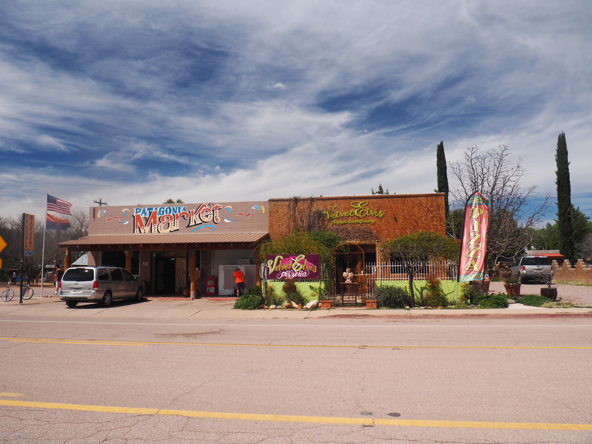
I checked into the Stage Stop Inn hotel in Patagonia, and started my laundry before anything else. I put everything item of clothing into the washing machine. I was walking back and forth to the laundry room with only a bath towel wrapped around my waist. I showered, put the clothes in the dryer, then called my cousin in Phoenix and had him ship me my ZPacks Duplex tent, my other BeFree filter, and a wicking sports shirt.
After my clothes dried I got dressed and went to the Wagon Wheel restaurant for a terrific hamburger.
On the Facebook page for the AZT class of 2019 group I posted my progress, and the lady with the sprained ankle at Bathtub Spring replied and said she had made it safely down.
Equipment Review:
ZPacks Arc Haul backpack: stellar! Not once did I feel anything on my shoulders in four days of hiking.
OpSack odor bag: junk. The zipper on both of the bags I was carrying separated cleanly from the bag (one one side) on day one, as if it had been cut with a razor. Also, on both bags the zippers developed a bump which prevented them from sealing tightly.
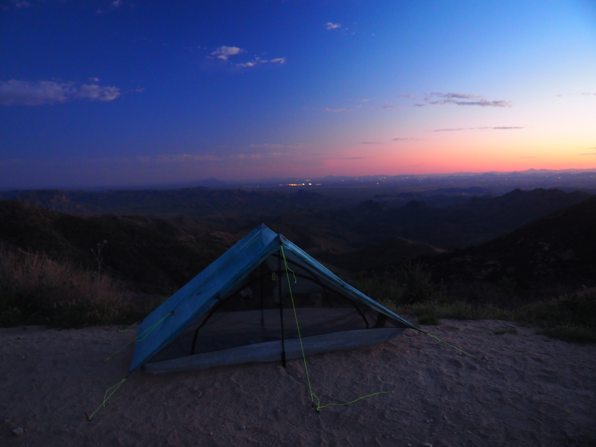
ZPacks Plexamid V tent: disaster. It held up to the winds on the first night but the condensation on nights 2 and 3 was intolerable. I hope I can return it, it cost $549. I have never had condensation in my ZPacks Duplex tent, because it has mesh doors on both sides and ventilates very well.
Ti Tri Caldera stove with wood burning option: It worked, but I got tired of taking the time to find wood for the fire, the soot got annoying, and I smelled like Smokey the Bear caught with his pants down (i.e., a forest fire). I did bring my alcohol stove with me just in case, so I sent the wood burning portions back. Now I will use alcohol for the rest of the hike.
Rota Locura trekking poles: At 9.7 ounces for the pair they are terrific, feather light. The straps got annoying so I removed them and sent them back. You can buy them with or without straps. Tip, if you are not sure, get them with the straps and remove the straps.
Enlightened Equipment Ultralight Evolution 30 degree quilt: great, despite the condensation in the tent.
I stayed in Patagonia one day longer than planned because the replacement gear my cousin sent would not arrive until Thursday.
Tuesday, April 2, Tucson Arizona
Immediately after I posted my last report I called my best friend, a person whom I met first day of high school, a person whom I was best man for, godfather of his eldest son, godfather of his aunt's daughter. He told me he has been diagnosed with stage 2 prostate cancer. It was a shocking blow. We talked at length and I tried to comfort him, but in the end there was nothing that I could do, it was in the hands of God and the doctors. At least the prognosis looked good, the cancer seemed to be localized and the odds were good that surgery would completely remove it.
Even though there was nothing that I could really do I felt very guilty for not being with him.
I had received the replacement gear that my cousin had sent, so I busied myself with unboxing it. The ZPacks Duplex was fine. But as I was cleaning the Katadyn BeFree filter, which was brand new, I noticed that it also had a pinhole leak!
This was not the makings of an auspicious beginning.
Friday, March 29
I woke up at 6:30, showered and then went to have breakfast at Gathering Grounds. There I met two hikers, Naomi and Mike, who are on the trail. I ate my breakfast and packed up and hit the trail at 8. It was a nice cool morning as I started down the 7 Mile stretch of Temporal Gulch road to the trailhead.
Around mile 4 I came up to a sign that said the road was closed and there was a detour for the Arizona Trail going off to the right. Apparently there was some mining activity and heavy machinery being used and no one was allowed to go on the road. I seriously debated whether I should ignore the sign and just proceed on the road, but I decided to take the detour. It was pretty nice with some great views but it added two miles to the length of the trail.
I finally came back to the road again and shortly after that as I was crossing a creek I met a southbound hiker who was sitting there having lunch. I decided to take a lunch break as it was about 12:30. We had a nice chat. He was from Moab, Utah.
At about 1:15 I set out again and very shortly after that began the two thousand foot climb of Mount Wrightson. My destination was Bear Spring, on the other side, where there was supposedly a nice place to camp. But when I arrived I saw a very small space which I did not feel comfortable camping in so I decided to continue to Tunnel Spring, 3.6 miles ahead. I knew there would be good campsites there because Tunnel Spring is right on a road.
I arrived at the spring at about 7:15 with almost no light left. So the first thing I did was set up my tent and then filter some water, then I made dinner and went to sleep.
The official mileage from Patagonia to Tunnel Spring is 18.8 miles, but the detour added 2 miles to that so I wound up doing 20.8 miles for the day.
Saturday, March 30
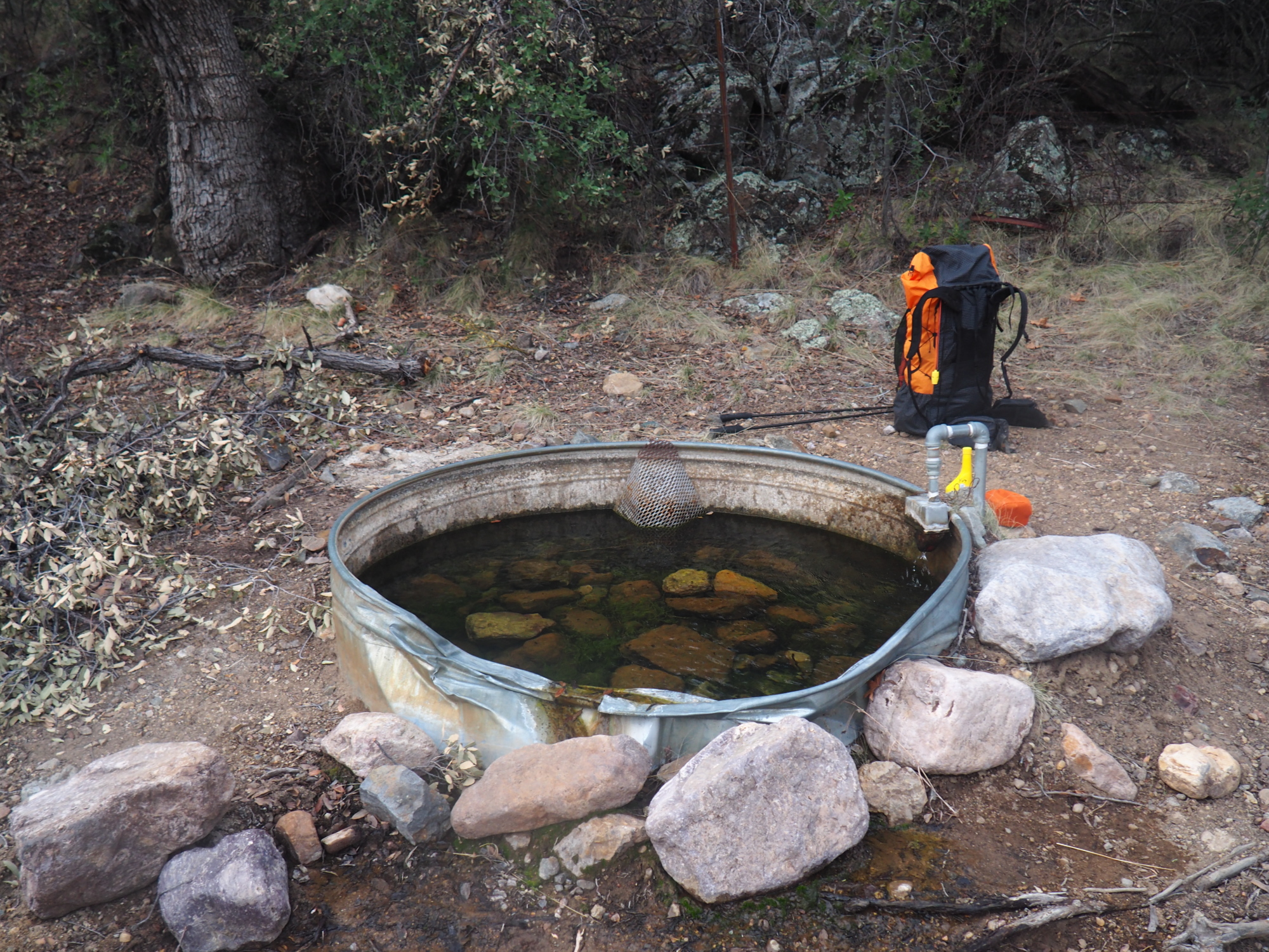
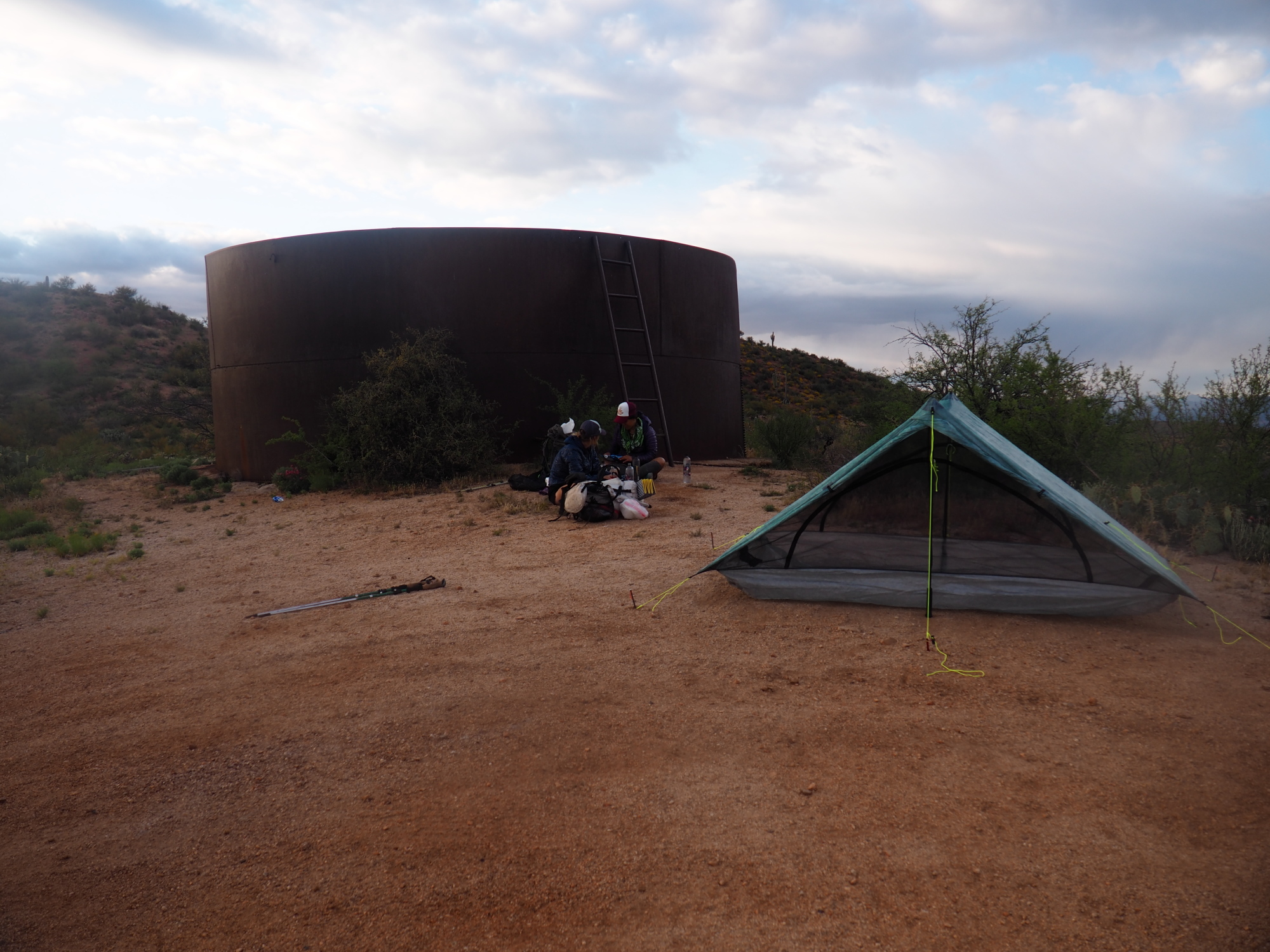
I woke up at 7, filtered water from Tunnel Spring, which flows into a metal tank, made breakfast and hit the trail around 8:15.
My ZPacks duplex tent was stellar, there was no condensation whatsoever in it.
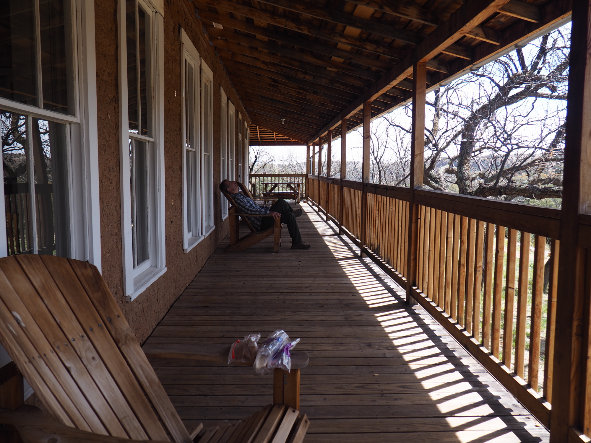
It was mostly downhill for the next 14 miles, the highlight being Kentucky camp 7 miles down the trail. Kentucky camp used to be run by a mining company, and it has been restored by the Coronado National Forest and the cabins can be rented. I arrived there at 11:30 and sat on the porch and relaxed for a few minutes. While I was relaxing a hiker came up, his trail name being Houston, and we chatted. I told him my trail name, Keepa, and he said he had been following my water reports in the Guthook app.
15 minutes later his hiking buddy, trail name Moose, arrived. They said they had ignored the detour on Temporal Gulch road and proceeded ahead, but were not allowed to proceed where the mining activity was, so they bushwhacked around it. I think I should have done the same thing.
At Kentucky camp there's tap water, and a kitchen with a refrigerator and a microwave. I used the microwave to cook my lunch, chipotle mac and cheese. While eating my lunch Naomi and Mike arrived.
I planned to spend only an hour at Kentucky camp. But it was so relaxing there that I wound up spending two hours. Houston and Moose did the same.
I hit the trail again at 1:30, and Houston and Moose followed me about 5 minutes later. About three miles later they caught up with me at the trail junction with the road and we continued on together for about a half a mile. Then I stopped for a couple of minutes and they proceeded ahead and I never saw them again. They were hiking very fast. Because they told me they had left Patagonia at 1 on Friday so they were 5 hours behind me but they had caught up with me the next day.
The next water source was about five miles away, so I carried 2 liters with me from Kentucky Camp. It was pretty easy going this part of the trail and I reached the water source, which required walking about 2,000 feet to a creek bed and supposedly going to a spring that feeds into a tank. But I did not have to go that far because the creek had flowing water and I got my water from there. I came back up to the trail and sat down and tried to figure out where would be a good camping spot ahead on the trail, because this part of the trail had been very rocky and camping spots were hard to find.
There was a nice camping spot right where I was sitting and I debated whether I should camp here but it was only 4:45 and there was two hours of daylight left. As I was checking the maps Naomi and Mike arrived and we discussed the camping situation. I decided to go ahead for about another hour in the hopes of finding a good camp spot. But there was none to be found until we hit a road about an hour later, two miles down the trail, where I saw a mobile home parked in a nice flat spot where I could pitch my tent. So I told Naomi and Mike that I would stop here for the night. It was 6 PM. They went ahead and I never saw them again.
I asked the people in the mobile home if I could pitch my tent right next to their car and they were very nice and said sure, and we had a long chat. They were going to Tunnel Spring the next day. I gave them the water reports and they were very glad that there was so much water out there.
The ground on that spot was very hard, and I broke one of my carbon tent stakes trying to put it in. So I asked the guy if he had hammer and he said he had a mallet, and then I asked him if he had a steel steak and he said no but he had a screwdriver and I said that would work. So I used the mallet and screwdriver to pound a hole into the ground into which I put my carbon stakes.
I made a note to myself that as soon as I got to Tucson I would buy one steal stake so I could use it for this very same purpose.
I had done 14.7 miles for the day.
Sunday, March 31
I had a good sleep; it was warmer than the previous nights because I was at a lower elevation. I woke up at 6:45, packed everything, made breakfast and chatted with the couple. I hit the trail at 8.
For the next two miles I could not see any place to camp, and I wondered where Naomi and Mike had camped.
It was mostly downhill as it had been since coming over Mt. Wrightson, as the AZT was descending into the desert.
I was in passage 6.
My next destination was a water tank six miles away.
My feet were hurting. The Kean shoes I was wearing had soft soles and I could feel every rock digging into the bottoms of my feet. This had been going on since I started the hike. I resolved to buy new shoes on the third day but it had to be done in Tucson. I couldn't mail order them because shoes are very tricky to fit.
I arrived at the water tank, it was silty and it almost killed my BeFree. I filtered 3 liters because the next dependable water, Twin Tanks, was 8 miles away. I was carrying one gallon of water. But it was cool and windy, so it wasn't so bad.
The trail continued its overall descent to the desert but there were many small drainages, so there were a lot of small climbs.
I ran across a couple of flowing Creeks on the way to Twin Tanks, I made a report in Guthook and continued.
The hike to Twin Tanks was nondescript. I could see the tanks, which are stock tanks, from about a half mile away. I saw an SUV drive and park next to the tank. I suspected it was a trail angel.
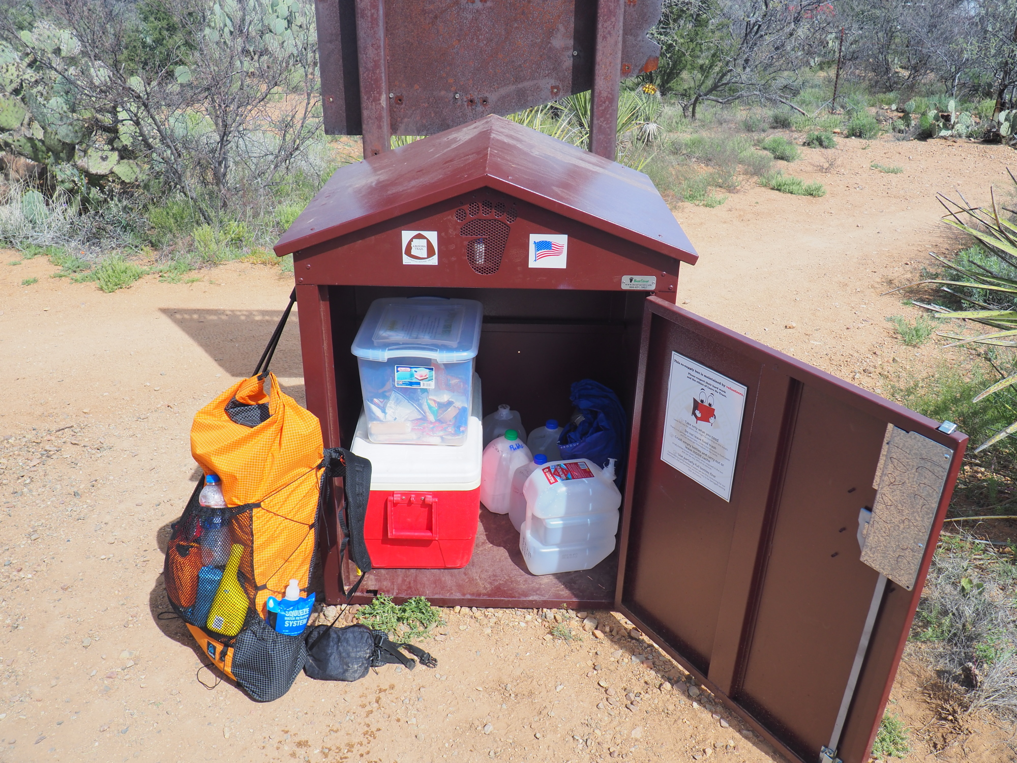
When I arrived the truck was still there, it was a guy and his wife, and he turned out to be the steward for passage 3. He was caching water for a couple of his friends who were arriving in a couple of days.
They offered me bottled water, which I gladly accepted, glad to avoid having to filter water from the cow tank.
And there were a bunch of cows at the tank, and prairie pies almost everywhere! I had to choose my campsite carefully to avoid the meadow muffins.
I made dinner around 6:15 and went to sleep at 8. The cows were bellowing and cooing all night, which actually was nice, and the place smelled like a farm.
I had done 15.7 miles for the day.
Monday, April 1
I got a good night's sleep. I woke up around 5:45, made a hot breakfast, with mint chocolate cocoa, and hit the trail at 7:08.
My destination was Colossal Cave Mountain Park, where I had resupply box waiting for me. But I never made it
It was an easy hike, with a constant and barely noticeable downgrade, almost like it was an engineered aqueduct grade.
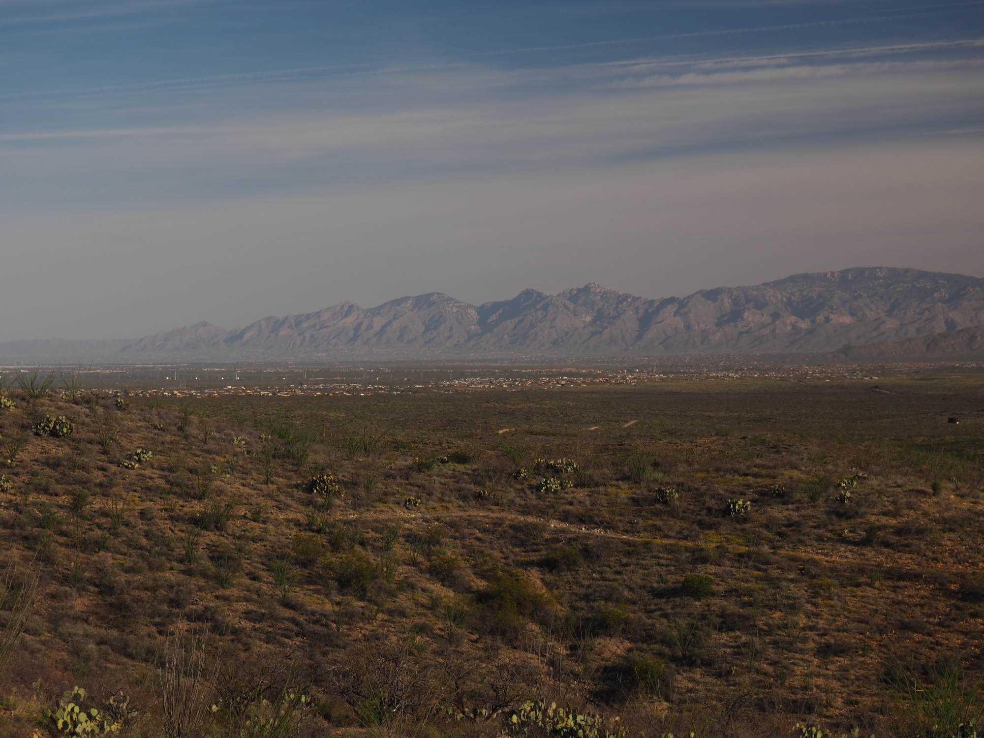
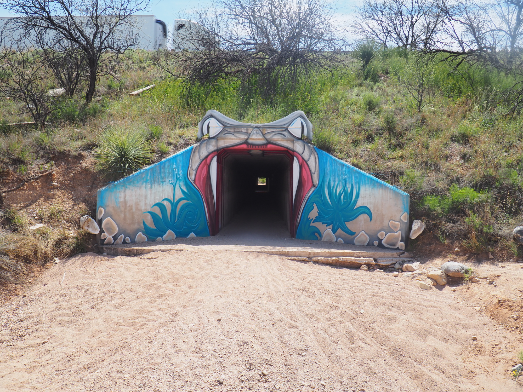
I would hit the famous AZT I-10 underpass in 10.8 miles.
I started strong but around mile 7 I started fading, mainly because of my feet.
I pushed on, finally reaching the underpass at 12:30. It was fun and cool in there.
The end of passage 7 was 1.5 miles away, at the Gabe Zimmerman trailhead. I reached that at 1:15 and called it quits. I had done 12.4 miles.
I was wiped out. I hitchhiked to Tucson, got a room for two nights and immediately soaked my body and aching feet in the bathtub for 30 minutes. Then I ordered a 12 inch pizza and a Greek salad and devoured them.
I did laundry, then went to bed at 8 and slept for 12 solid hours.
The next day I went to REI and exchanged the BeFree, bought new shoes (Oboz) with very solid soles, bought tent stakes and chilled for the rest of the day.
Wednesday, April 3
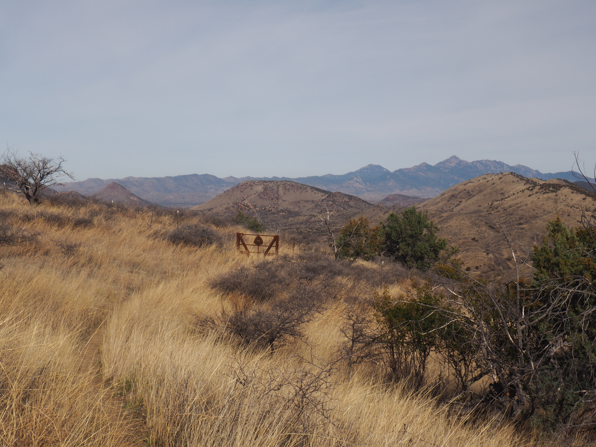
My permit for camping at Manning camp in Saguaro National park was for April 5. I had two days to hike passage 8, which is 13.9 miles.
I arranged a ride to the Gabe Zimmerman trailhead with a trail angel, Gregory Rogan, who is very nice. I told him we needed to stop and buy HEET for my alcohol stove and he bought it for me and refused to be reimbursed. The ride was also free. It turned out we are both musicians, he in Americana, as he described it, while I am a classical composer (you may hear my music at boogiedrop.com).
We arrived at the trailhead at 9:30. I lounged around for 30 minutes, took care of job #2 at a porta-potty, and then hit the trail at a leisurely pace at 10.
My destination was Colossal Cave Mountain Park, 7 miles away, where I had a resupply box waiting.
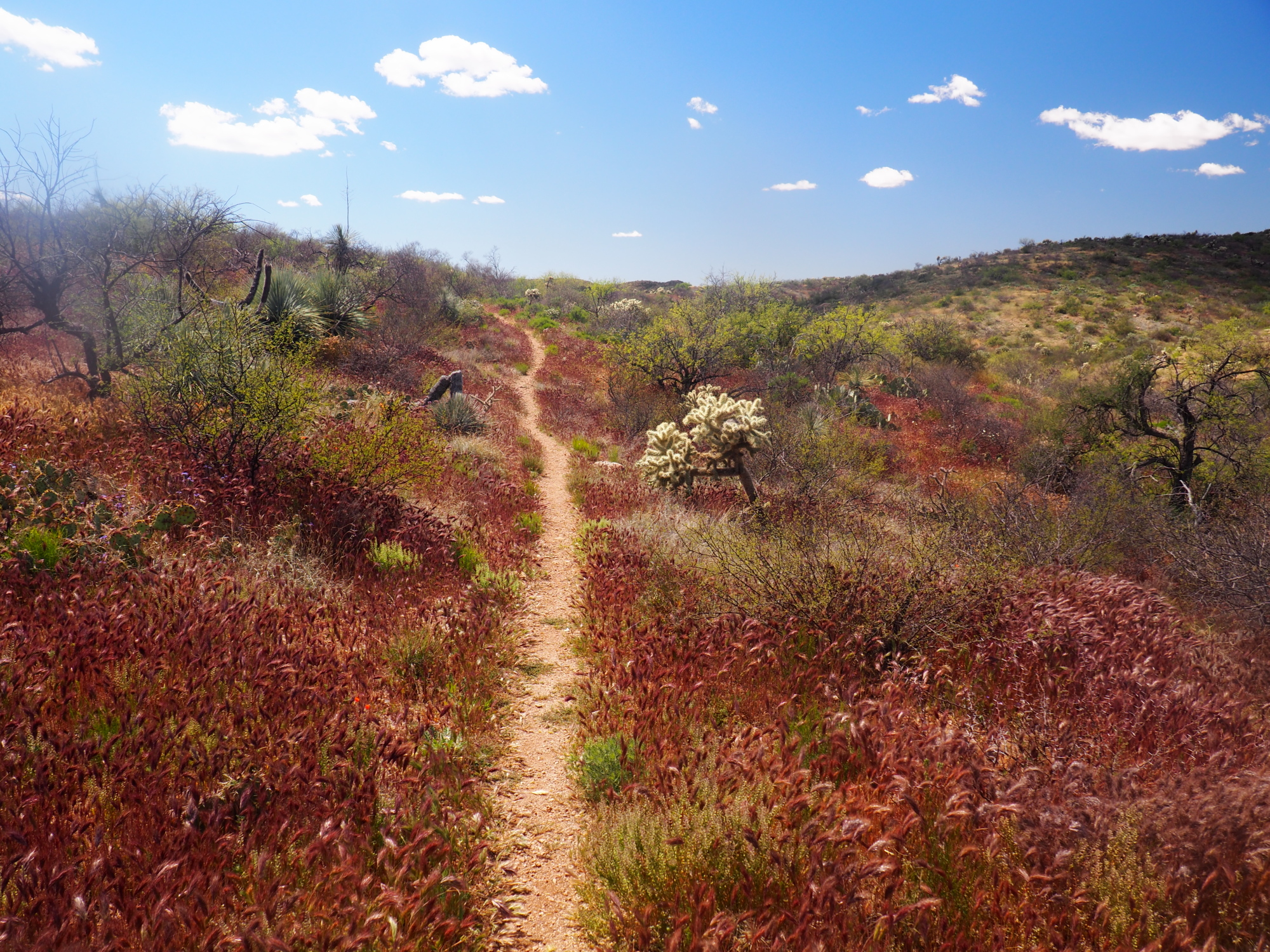
Passage 8 of the AZT goes through the Davidson Canyon recreation area, a beautiful area to hike and camp in. This was turning out to be my favorite passage of the AZT so far.
I saw a Gila monster, got good video of it. It's the second time I have seen one, the first was at Organ Pipe Cactus National Monument a few years ago.
I made it to Colossal Cave at 1:30, had two Lemon-lime Gatorades, a hamburger and guacamole and chips.
I then claimed my resupply box and realized I had packed too much food. But it did give the option if skipping my next resupply stop, something that I would consider when I got to that point.
I sat at the visitor's center until 4:30, paid for a campsite, then hiked to the Las Selvilla picnic area and campground, which had a water spigot, and which the AZT passes through.
There I met an AZT hiker, Steady Eddy, who turned out to be from Chicago, and an Australian husband and wife, Charlie and Joy, who were biking the AZT.
A local who lives close to the campground had met Charlie and Joy earlier and had left trail magic at their picnic table: chips and avocados, beer and carbonated drinks. We shared that over dinner.
All the main meals in my resupply box were from Packit Gourmet of Austin, Texas. I have never had freeze dried food that tastes so good. I highly recommend it. I had shepherd beef pie and mashed potatoes for dinner. It was terrific. I followed that with an Early Gray sweetened with honey crystals (my luxury item).
I hit the sack around 8.
Thursday, April 4
I woke up at 6:30, leisurely packed up everything except my tent, and then started breakfast: scrambled eggs with pork sausage. I was apprehensive because every freeze dried scrambled eggs I have tried has been terrible. But Packit Gourmet delivered again. It was delicious. I followed that with hot chocolate cocoa and a cranberry cookie.
I lounged around until 9:30, having only 7 miles to cover for the day. Then I hit the trail a minute after Steady Eddy did. He was going to camp at Grass Shack campground tonight then go over Mica Mountain tomorrow.
My destination was indefinite, a camping spot about 7 or 8 miles down the trail. I was still in passage 8 and it continued to be beautiful.
I reached Rincon Greek about 1 PM and stopped for a lunch break, I had covered 6.5 miles. I had another terrific meal from Packit Gourmet, filtered 2 liters of water then continued.
I crossed into Saguaro National Park about a tenth of a mile later, then reached Hope Camp (where camping is not allowed) about a mile later. It is right next to the trail. I decided to camp there. It was about 2 PM, and I had covered 7.3 miles.
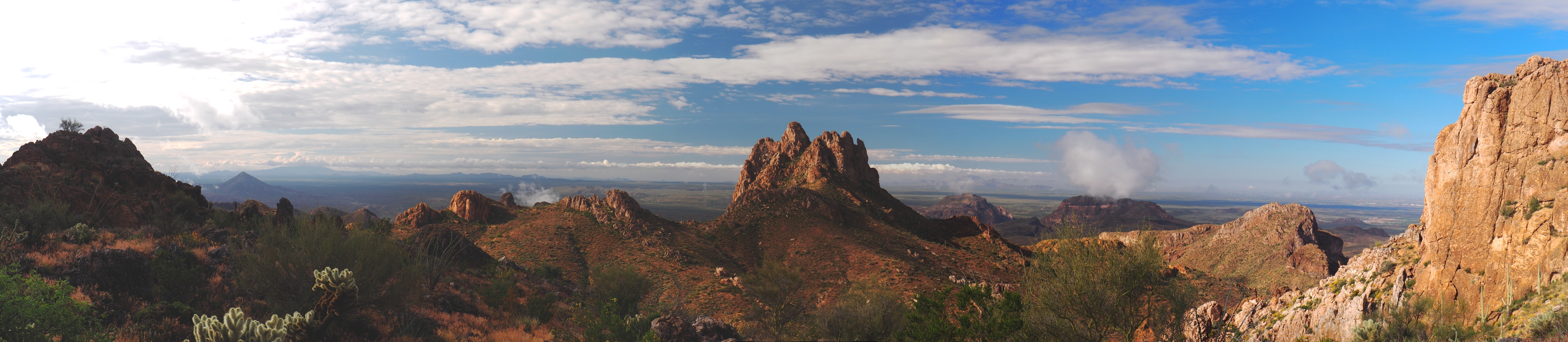
At about 2:30 a couple of hikers arrived. They were foreigners. We chatted for a couple of minutes. They did not know that they needed a permit to Camp up at Manning camp and complained that nobody told them about it, even though it is clearly stated on the Arizona trail website. So they said they were going to hike 2 miles further down to the creek, camp there, and then the next morning go up and down the mountain in one day. I thought this ill-advised, since it is 20 miles to go up and down with a 10,000 feet elevation change. I did not say anything though and they went on their way. In retrospect, I should have advised them just to camp at Manning camp without a permit, since in all probability there would be no ranger there to check on them.
Tomorrow would be the 12.6 mile trek to Manning camp, with a 4806 feet climb.
Friday, April 5
I woke up at 6:15, had a hearty breakfast and then hit the trail at 7:30.
The first two miles to the creek, which marks the wilderness boundary of Saguaro National Park, were relatively flat. I reached the creek in 40 minutes, filtered 2 liters of water there and then began the climb, my destination being Grass Shack campground, 6 miles ahead and 2000 feet up.
I set out from the creek at 8:45. It was a cool day, upper 60s with a nice wind. Not bad for a strenuous climb.
And strenuous it was. The switchbacks were short, which means they were steep. I lumbered on, snapping photos and videos along the way, as the views were terrific.
I made it to Grass Shack at 1:30. There was a hiker camped there. I went to the bear box and used that as a table to make lunch, another delicious meal from Packit Gourmet.
After eating lunch I lay on the ground, used my backpack as a pillow, and took a power nap.
25 minutes later I woke up and I noticed that the other hiker was lying beside her tent. I waved at her and she waved back and she came over and we chatted a little. She was a local who came up to Grass Shack to film and take pictures of a waterfall that she discovered nearby another time she was doing this hike. I told her I'm going up to Manning camp, and the climb was going to kill me. She said it's not so bad, but I was dubious.
At 2:30 I set out for Manning camp. The initial half mile from grass Shack was a little tough but then the grades became gentler and the switchbacks were much longer and the trail itself was nice and relatively rock-free. I picked up my second wind and I felt very good as I climbed up.
It was 4.6 miles and 2650 feet to Manning Camp.
Even though it was a cool day I was drenched with sweat as I climbed up and my hiking shirt was completely wet. I was getting a little chilly because of the wind, so I put on my windbreaker. I would have to change my clothes immediately upon arriving at camp.
When I reached Chimenea Creek, about .4 miles from camp, it began to hail a little for about 45 seconds. That concerned me and I hoped that it wouldn't be like that for the rest of the night.
The temperature had also dropped. I knew I had to change my clothes, and I knew exactly where I would do it, in the out-house, which would be a little warmer than the outside.
I reached Manning camp at about 5:45. I saw a ranger building complete with propane tanks, it was fairly large. So I decided to go see if it was open but no such luck, it was locked. I saw a thermometer above the door, which read 58 degrees.
So I made for the outhouse, and I was right, it was warmer in there by about 5 degrees. I got out of my wet shirt and my hiking pants and put on my wicking shirt and wool shirt, which I normally sleep in, and put on my Merino wool long johns and my silk long johns.
There were three locals from Tucson camping there for the night, we chatted a little. I told them in my opinion the ranger building should be kept open in case of emergency. One guy asked me what kind of emergency? I said hypothermia. He said very callously "that's your problem." I said in Norway they usually keep these kinds of buildings open just in case of emergencies. He said we are not in Norway. I did not pursue it any further.
I remember reading in the book Beneath the Window, by Homer Wilson's daughter, that all of the people who lived in the Big Bend area at the time used to keep their homes open for any stranger to come in and use, because it was such a harsh environment it could have meant the difference between life and death.
My campsite had a bear box next to it, a huge fireplace with a metal grate, and even a rocking wooden bench. I set up my tent quickly and then cooked dinner right next to the fireplace. I then placed everything into the bear box and went to sleep.
At around 1 in the morning it rained for about 5 minutes.
Saturday, April 6
I woke up at 6 but didn't leave the warmth of my quilt until 6:30. Then I got up and made breakfast.
I left my tent standing because I wanted it to dry. The sun finally came over the mountain around 7. The sunlight was reaching my campsite but there were trees and it wasn't fully hitting my tent. So around 7:45 I struck my tent and went downhill about a hundred feet to a large exposed rock outcrop and lay the tent there in full sunlight, and also my shirt.
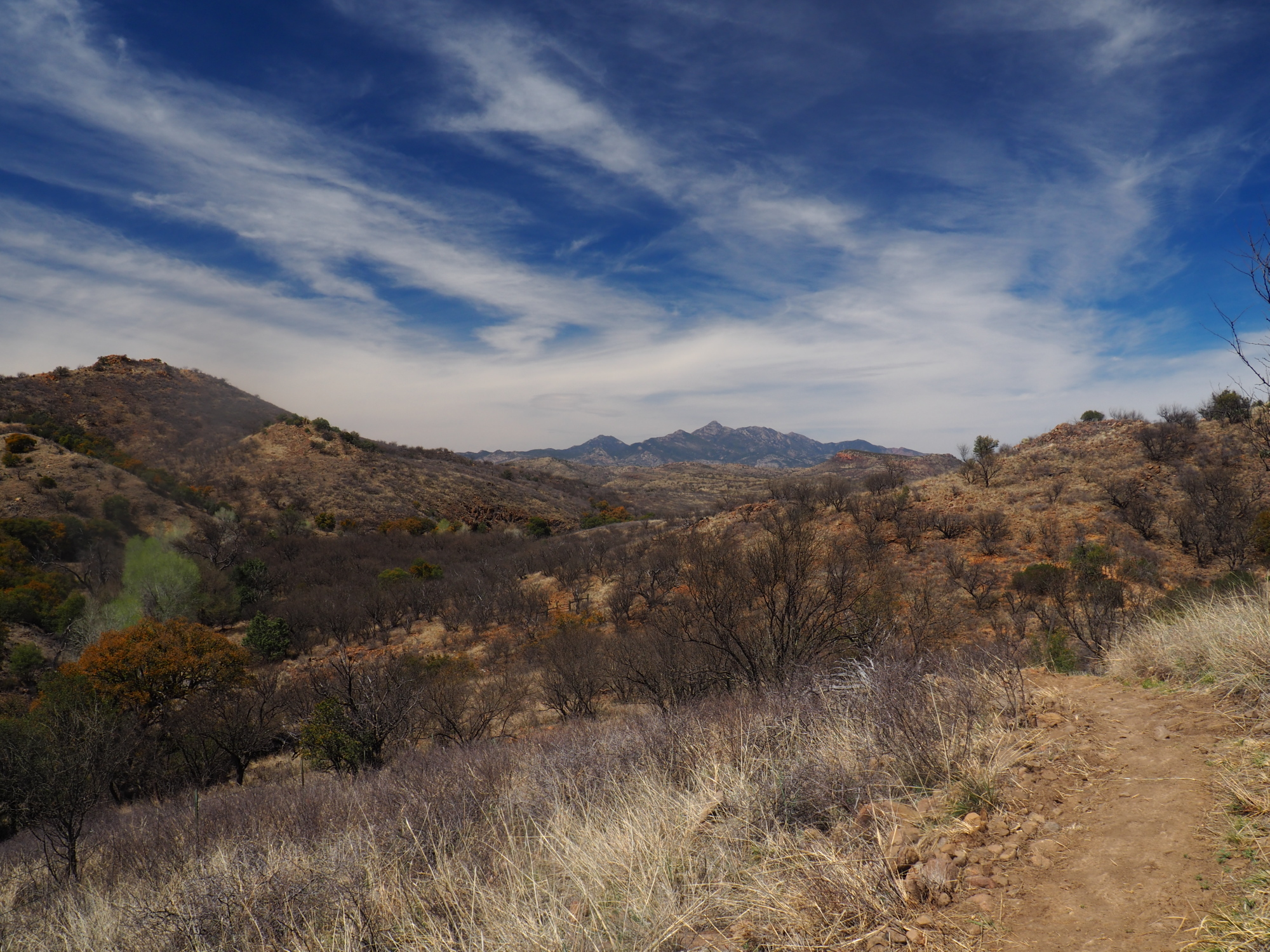
At about 8:20 I packed everything up and hit the trail. I still had an 800 foot climb to get to the highest point of Mica mountain but after that everything would be downhill.
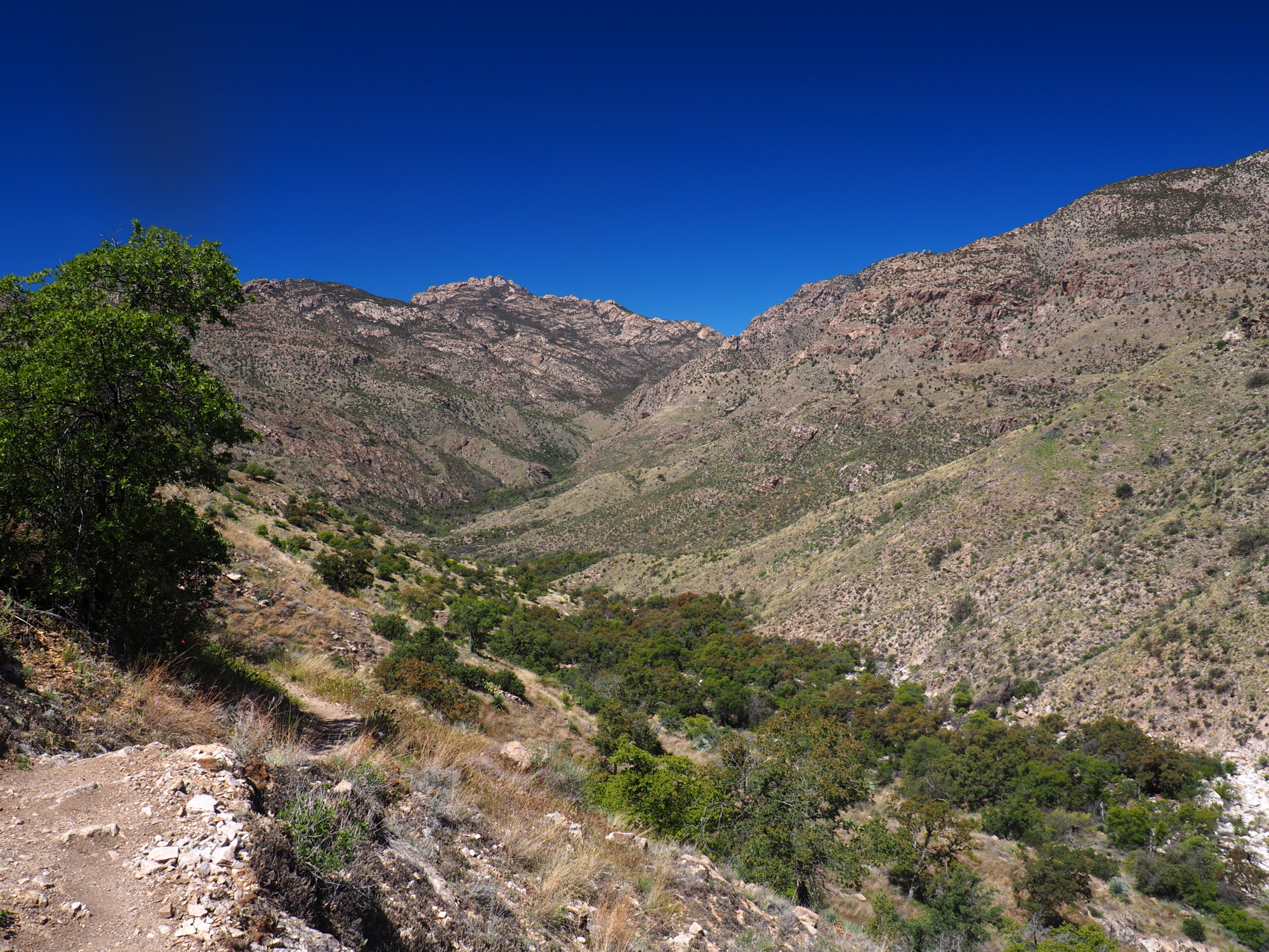
It was a steep and rocky descent, with sections of the trail that were overgrown. There were three or four water sources flowing as I descended and I reported them in the Guthook app. My destination was Tanque Verde canyon, 6.2 miles down, where there was a strong Creek flowing and where I would have lunch.
I made it to the creek by 1:30. I had a quick lunch, filtered 2 liters. It was overcast over Mica Mountain and over where I was sitting at the creek. I felt a few drops and I prayed that it would not rain.
The worst part of the descent was behind me now, as shortly after Tanque Verde canyon the trail became flat and smooth for about 2 miles. I was in a very beautiful, grassy meadow.
It was 5 miles to the Redington road trailhead and nine miles to my next reliable water source.
I found two more water source between Tanque Verde canyon and Redington road, one of them only a quarter mile from the road. I was pretty tired, so I filled up at the source close to Redington road and decided to hike two more miles and dry camp about 2 miles from the next water source.
I hit the sack at 8.
Sunday, April 7
I hit the trail at 8. The Gordon Hirabayashi trailhead was only 11 miles away. There I would hitch hike on Catalina highway into Tucson for a zero day.
I stopped at The Lake but the water was not appealing so I went on ahead because the next water source, Agua Caliente Drainage, was only 2 miles away.
I was in passage 10 of the Arizona Trail and it was pretty easy going, except for a couple of short climbs. I made it to the Gordon Hirabayashi trailhead by 1:30.
I hitch hiked into Tucson where I did my usual routine of renting a room and doing my laundry.
The Oboz shoes were terrific. My feet problems went away completely.
On another note, the Wysi Wipes I am carrying for toilet paper are an amazing success. I have one month's supply at only 3.5 oz. Also, they are made of cellulose and are therefore biodegradable, so you can bury them.
Monday, April 8
I took a nero (nearly zero) day in Tucson yesterday and hit the trail again today.
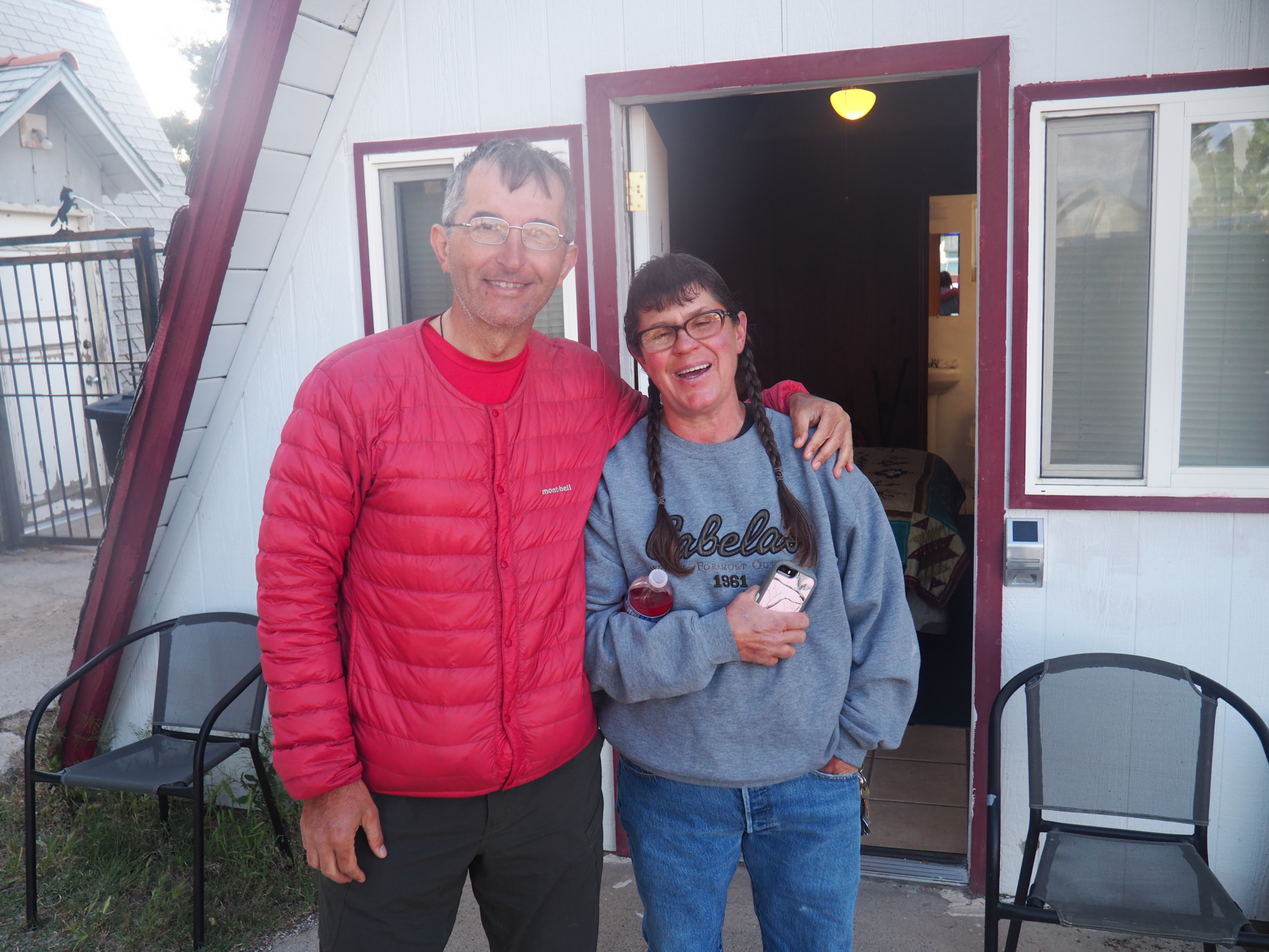
I arranged to be shuttled to the Gordon Hirabayashi trailhead with a trail angel. His name is Scott Bosworth, a very nice guy, a retired army veteran who came to the Tucson area to help with his PTSD.
I arrived at the trailhead at about 9:25, used the bathroom and then hit the trail. My primary destination was Lemmon Creek, 15 miles away. My secondary destination was Summerhaven, 18 miles away, depending on how I felt and how much time I had by the time I got to Lemmon Creek.
I carried two liters of water, as there was water on the trail. My intermediate destination was Hutch's pool, 7.1 miles away, a local favorite. It is a permanent pool with a sandy beach where you can camp.
The first mile to Hutch's pool was a gentle climb, and then a descent all the way to the pool. I made it there in about two and a half hours, and had lunch at the pool.
The 4000 feet climb to Summerhaven began at Hutch's pool. It was 2200 feet in 5 miles, up to Romero pass. It was not bad at all. At Romero pass the trail joined Mount Lemmon Trail #5, and there was a brutal climb of 1400 feet in 1.2 miles. It destroyed me. Any thought of making it to Summerhaven vanished.
I finished the climb. It was about 5:30, and still about 2.8 miles to Lemmon Creek. I pushed on but I doubted I would reach the creek. Although the trail was descending, it was very rocky and the progress was slower.
I found a very nice camp spot with a fire ring 1 mile from Lemmon Creek, and right next to a water source. So I stopped there and called it quits.
I was in an area with bighorn sheep, and I heard them all night, and that's what I thought I was hearing. But the next day I was informed that those were actually bullfrogs.
Tuesday, April 9
The next morning I hit the trail at 8. It was 4.7 miles to Summerhaven with a 650 feet climb, and I thought I would cover that in about 3 hours.
But the Mount Lemmon Trail #5 is very rough, and it was slow going. I didn't make it to Summerhaven until 12:15.
I was tired even though I had done only 4.7 miles.
I checked out the town, which is very small, for the next 15 minutes. I visited the hiker friendly general store, where they give free coffee and hot cocoa to AZT hikers. I bought a Gatorade and said I would be coming back later.
Then I went to the Mount Lemmon Cookie Cabin Pizza restaurant, where they have pizza and wonderful cookies, among other things. I ordered a slice of pizza and a BBQ chicken sandwich.
While sitting there eating my food, an AZT hiker came up to me and introduced herself -- her Trail name being Capitan. I invited her to join me at the table and she did. She told me she was hiking with two other women and they would be arriving shortly.
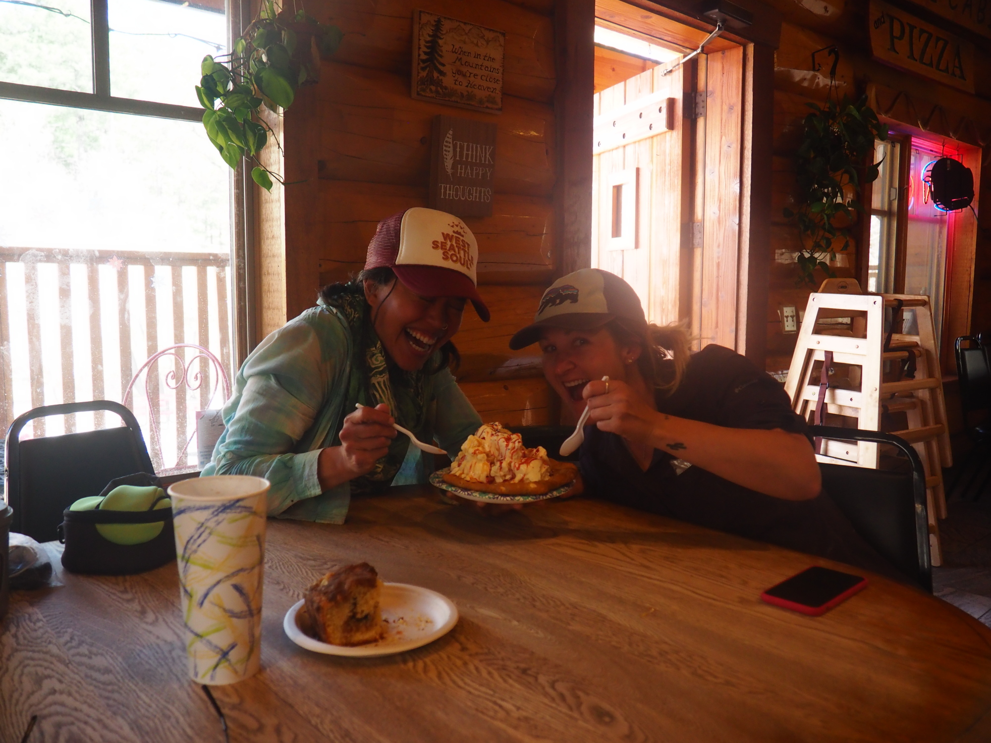
About 15 minutes later the second woman arrived, her trail name being Honeydew. We moved to a larger table. 30 minutes later the third woman arrived, her trail name being Rome.
We discussed whether to continue hiking a few miles further or to stay in Summerhaven for the night. I told them I was anxious to sleep in the bathroom of the community center, which many hikers do. I just thought it would be a fun thing to do. Also, I was really tired and I did not want to make a descent from Mount Lemmon today.
There was a saddle 3.1 miles down the trail, called Dan's Saddle. I suggested that if they wanted to continue that would be the best place to find a camping spot, because everything after that was a descent.
Honeydew was also keen on sleeping in the bathroom of the community center, as she also thought this would be a fun thing to do. Capitan and Rome were not convinced, but by 3:30 the idea of pushing on was gone and they decided that they would sleep in Summerhaven for the night.
The four of us sat at the restaurant until about 4:15, 15 minutes after closing time, then we went outside and came across another AZT hiker, his real name Milo. He was only 15 years old.
Around 4:30 we all went to the general store and lounged around there. I bought some cold cuts and crackers and eggs and cheese for dinner.
Milo informed us that a hiker named Legend would be arriving around 6. Legend was attempting to break the fastest known time hike of the Arizona Trail.
The general store closes at 6. 2 minutes before closing Legend arrived and went straight in to buy some food, and then he joined us sitting in front of the general store.
He informed us that he was doing at least 50 miles per day. Amazing.
The owner of the store came out around 6:15 and was very friendly, she told us we could sleep in the bathrooms and vestibule of the community center or in the post office, which is open 24 hours a day and is heated.
At 6:30 we all moved to the community center. We had dinner in the vestibule and Legend charged his phone. He left 15 minutes later; he was going to hike till about 10 or so. His destination for tonight was High Jinx ranch, 12 miles away, where he had a supply box waiting for him.
We debated whether to sleep in the bathroom or the post office. In the end Rome slept in the bathroom, and the rest of us went to the post office.
The community center was rented by a group of pastors, who were having an ecumenical meeting. They were very nice; they invited us to join their service.
The four of us settled in the post office. But around 9:30 Capitan decided to go back to the vestibule. The bad thing about the post office is that you couldn't turn off the light, and it was very bright in there. 30 minutes later, Honeydew also went to the vestibule of the community center. Milo and I remained in the post office.
Wednesday, April 10
I could not sleep. In fact I did not sleep at all the whole night. At 5:45 a.m. I packed up and went to the vestibule, where the others were awake and having breakfast. I ate a big cherry turnover I had bought the day before, and drank a hot cocoa.
I told the others that because I had not slept all night I wanted to stay another day and rest, because I didn't want to hike without sleep. They left at about 6:35. Then I thought about it and decided to go for it and hit the trail at 6:50 a.m.
The wind was gusting fiercely, and it knocked me off balance several times. It remained like that for the whole day as I descended from Mount Lemmon. It was also very cold.
I don't know why, but I had a burst of energy. I don't know where it came from. I was making terrific time and I made it to Dan's Saddle, 3.1 miles away, in 1 hour and 10 minutes.
The saddle is a 400 foot drop followed by a 400-foot climb. If I'm making a 4000 foot descent from Mount Lemmon, I shouldn't have to make an 800 feet elevation change in the process.
End of rant.
The saddle was very rocky and had no good place to set up a tent or camp. In retrospect it was a good decision not to proceed the previous night. Looking at a flat area on a map doesn't necessarily mean that you can camp there. It depends on what's covering that area.
I caught up with Rome shortly after I climbed out of the saddle. And we pretty much hiked together to the American Flag trail head, where we would be picked up and driven to our motel in Oracle.
Capitan, Honeydew and Milo we're about 30 minutes ahead of us. We arrived at the trailhead at 1:10 PM. I had done the 14.6 mile descent in 6 hours and 20 minutes. And I don't know why, but I still had energy when I arrived at the trailhead.
I had reached mile 200 of the AZT.
The person picking us up was Marnie, the owner of the Chalet Village motel in Oracle. We called her about an hour before we arrived at the trailhead and told her we would be there at 2. The five of us sat for about 45 minutes until she arrived.
Marnie and her husband Jim are very nice people. They are trail angels and they cater to AZT hikers. The motel was completely booked with AZT hikers. I did not have a reservation but they rented me their old mobile home. Milo was going to camp in their backyard but I told him he could sleep on the sofa in the mobile home.
There were seven hikers in all staying at the motel, and we all went out to dinner to an Italian restaurant which had very good pizza.
I slept for a solid 9 hours in the mobile home. The next day I got my own room. Milo left and hit the trail. Capitan and Honeydew remained and took a zero.
Friday, April 12
I got up around 6:30, having slept very well in a comfortable bed. I waited for the others to wake up. Around 7 Capitan and Honeydew emerged and said they were not going for breakfast. I told them I would.
I settled my bill. Marnie did not charge me for the night in the mobile home. That was nice of her. The night before I had invited them for breakfast. I wanted to show my appreciation for these terrific people and trail angels.
Marnie and I went for breakfast around 7:30. Her husband Jim would bring Capitan and Honeydew to the trailhead and then join us.
We sat at our table, joined by another hiker, Coach, who had come straight from the trail to breakfast. After we ordered, Jim, Capitan and Honeydew showed up. They wanted to say goodbye to Marnie. After doing that Jim drove them to the trailhead.
He came back 20 minutes later, his food waiting for him.
I had an egg, cheese and bacon croissant with fruit, two glasses of orange juice followed by a cherry almond pie with whipped cream and coffee. It was delicious.
At 8:15 Marnie drove me to the trailhead. We arrived there at 8:25. I said my goodbye and hit the trail at 8:30.
Most of this stretch of the AZT was flattish, with minor climbs. I made good time. About 11 miles later I caught up with Capitan and Honeydew, who were sitting in a wash having their lunch.
I had my lunch already, but I joined them for about 15 minutes then went on.
My destination was Mountain View tank, a reliable water source, where I would camp. It was about 12:30 and Mountain View tank was 10.9 miles away. The terrain became hilly but not very bad. I pushed on and made it to the tank at 5:30.
I immediately filtered water. The tank is round, about 9 feet high and 15 feet in diameter. There is a ladder which I climbed to get to the water, which was about 2.5 feet below the rim. I had to carefully lean down, making sure that neither I nor my water bladder fell in.
Fifteen minutes later Capitan and Honeydew arrived and began filtering water.
There was a flat spot about 15 feet from the tank where I pitched my tent. Capitan pitched her tent right next to the tank. Honeydew went up the road about 150 feet.
I had hiked 20.9 miles for the day.
It was a nice, cool night. I hit the sack at 8, woke up at 1 and took some nice star pictures, then went back to sleep at 2.
Saturday, April 13
Honeydew hit the trail at 6, followed by Capitan at 6:30. I filtered 2 liters of water before hitting the trail at 7:37.
I was concerned about a potential 20 miles stretch with no water. So at about 8:30 I found mobile coverage and called Marnie and asked her if she and Jim had cached water at the Freeman Road trailhead, which was at mile 10 of that stretch. Marnie, bless her heart, said they had driven there the night before and cached water. That was a great relief. I sent a text message to Capitan and Honeydew informing them of this.
I pushed on. The AZT continued to be flattish, with a couple of bigger climbs but nothing bad.
At around 10:30 I arrived at Beehive Well, also a round tank but only 6 feet high. The water was green but it filtered fine. I got 1 liter.
Speaking of filters, my Katadyn BeFree was degrading, and no matter how much I cleaned it, it would become painfully slow, taking about 8 minutes per liter.
Capitan and Honeydew were using the Sawyer, and they always filtered twice as fast as me. I think that Sawyer's back-flushing cleaning method is more effective than Katadyn's swish or shake method. Because if you think about it, swishing and shaking is not going to clean the hollow fibers toward the center of the filter, because they are shielded by the outer layers, whereas back flushing gets them all.
I will switch to the Sawyer after I reach Phoenix, where I am attending my cousin's wedding on April 26.
At 12:30 I found Capitan sitting in a wash having lunch, so I sat with her for a good hour and a half. The Freeman Road trailhead was only 5 miles away, so there was no rush.
I left at 2. Capitan caught up with me and passed me 30 minutes later.
I arrived at the Freeman road trailhead at 4 to find Capitan and Honeydew sitting under a gazebo. I put my pack down and went to the water cache and got a gallon of water.
At 4:45 we hit the trail. We planned to hike until 6 or so. At 5:30 we found a very nice camping spot under a tree and decided to call it a day.
We had done 16.9 miles for the day.
Sunday, April 14
Honeydew was first to leave in the morning, as usual, at 6:30, followed 15 minutes later by Capitan. I hit the trail at 7:15.
The next 11 miles of the AZT were flat, and I mean pancake flat. It was easy going and fast mileage. It was cool and partly cloudy, great for hiking. I had 2.25 liters of water with me until the next water source, Wildlife Tank, 10 miles away.
I saw a rock outcrop in the distance and the AZT was heading for it. When I arrived there I found Capitan and Honeydew sitting in foldable chairs, which a trail angel named Nankoweep had left there, in the middle of nowhere, along with snacks and water.
We sat there for 30 minutes then Honeydew left, followed by Capitan. I walked a short distance to a concealed spot and took care of business.
I caught up with Honeydew about 30 minutes later but stayed behind her about 5 minutes until we reached Wildlife Tank at 11:30. Capitan was already there.
I had a quick lunch and then filtered 2 liters of water, which took 15 minutes. This was unacceptable.
Capitan said she wanted to eat lunch elsewhere, so she and Honeydew left as I began filtering water.
I resumed hiking and found them 20 minutes later sitting in a wash under a tree. Capitan had used her Tyvek tarp to create a canopy, and Honeydew her umbrella, so we had nice shade.
Our next water source, in Ripsey wash, was only 5.7 miles away. We we're in no hurry to leave and we lay there for 90 minutes.
Finally we left. Honeydew went first, I followed 10 minutes later. I passed her about 1.5 miles later.
I met a couple hiking the Grand Enchantment Trail. I stopped to talk to them and Honeydew caught up with me. Then I started again.
As I was descending into Ripsey wash I met a woman also hiking the Grand Enchantment Trail, and she was from Chicago, from the neighborhood adjacent to mine. Small world.
Ripsey wash was not what I expected. It was a lush, green paradise.
I filtered 3 liters of water at a cement tank fed by a spring. It was cool and great tasting.
I found a great spot to pitch my tent and had the best night of sleep so far on the AZT. It was in the 50s.
Monday, April 15
I woke up early and hit the trail at 6:23. Honeydew had left first, followed by Capitan.
I passed Capitan 2 miles later, as she had climbed up a hill to take some pictures. Honeydew was ahead of me about 7 minutes.
There was a 700 feet climb over 2 miles out of Ripsey wash, and it was all downhill from there to the Florence-Kelvin trailhead.
The views were terrific.
I arrived at the trailhead at 9:37. Honeydew was already there. Capitan arrived 5 minutes later.
We all had to go to Kearny to resupply. I flagged down a car and hitched in. Capitan and Honeydew did another 2 miles of the trail to the Gila River Bridge and hitched in.
I went to the grocery store, bought food for 2 days, relaxed, had lunch at the hot bar, cleaned my kitchen gear, then met Capitan and Honeydew at noon at the Old Time Pizza restaurant, where I ordered a calzone for the night's dinner.
The owner of the restaurant, Loraine, is very hiker friendly. We stayed there until 3:45, and then she drove us to the Gila river bridge. There we met two hikers resting, Coach and DJ Night Cake.
We sat there talking for 45 minutes. Coach left. The four of us hit the trail at 5, our destination a campsite by the river 3.6 miles ahead, next to the railroad bridge over the Gila River.
There were terrific views as we climbed and then descended to the Gila River. We arrived at 6:20 and sat chatting until 8:30. DJ Night Cake wanted to push on for another 3 miles. He said he was low on food and phone battery. All of us were carrying battery packs. Honeydew let him charge his phone and I gave him a bag of trail mix and 6 Welch's fruit snacks. He decided to camp with us.
It was a nice day. We had done 13.3 miles.
Tuesday, April 16
DJ Night Cake was first to wake up, around 5:15, and the rest of us around 5:30. He thanked us, got our contact information and left.
I had a snack in lieu of breakfast and hit the trail at 6:30. Our destination was the Gila River 7.8 miles away, where we would filter water and eat.
I started with 1.25 liters of water, the others with 1. I was slightly concerned but it was a cool morning.
This stretch of the AZT was not what I expected. The guidebook describes it as following the Gila River, but it did no such thing. It was high above the river.
The views were terrific.
I reached the river bank at 9:40 and began filtering water. Honeydew and Capitan arrived 5 minutes apart.
We had been hiking together since we met in Summerhaven. It was our custom to stagger our departure times whenever we converged so that we would not be on top of each other.
We all filtered 2 liters and had "brunch." We stayed there until 11:30 and then I left, followed by Honeydew and Capitan.
Our destination was again the Gila River, 6 miles away, where the trail would leave the river and ascend the canyon. There we would have to carry 1 gallon of water to dry camp as we ascended the canyon.
This stretch was mostly level, with terrific views in the last mile.
About .5 miles from the river access point I encountered three Jeeps. One of them stopped and a man asked me if I was hiking the AZT. I said yes, we chatted for a few minutes, and I asked him if he had water. He said yes and I got a liter.
I then proceeded to the trail junction and waited for the girls. While waiting I took care of business.
They arrived at 2 and we walked one hundred yards to the river, to a spectacular bank with terrific camping sites. We considered camping there but it was too early in the day.
I filtered 2 liters and then joined the girls in dipping my feet in the river. It was cold and nice.
We stayed there until 4 and then I left. Our destination was a camp site 2.5 miles and 1000 feet up the canyon, with reportedly terrific views.
It had become overcast and cool, which made the ascent easier. It was also extremely windy and threatening to rain.
The climb was not bad. I reached the campsite at 5:30. It was extremely windy and not favorable for camping. The views were terrific.
It began to drizzle.
Honeydew arrived 10 minutes later and we agreed we could not camp there. There was a dirt road going down and I walked down about .2 miles and found a large grassy area suitable for camping. I walked back up to find that Capitan had arrived. We agreed to camp in the grassy area.
It had started to rain lightly.
We walked down and immediately setup up our tents. It rained sporadically as I cooked dinner in the vestibule of my tent.
The three of us then sat in Capitan's tent and chatted and planned for the next day and then we went to sleep.
We had done 15.9 miles for the day.
Wednesday, April 17
At 4 AM it started to rain heavily. After 15 minutes of this I checked inside the tent to make sure all was dry. There was a small pool of water at my feet. My backpack had pushed the tub below the canopy of the tent and the water was rolling down the top and into my tent. I used my bandana to soak the water out and adjusted the tub. Fortunately only my Darn Tough socks got wet, but they were the pair I wasn't going to wear the next day, so I considered that laundry.
I also realized the poles holding up the tent were a couple of inches too short, as there was a little sag in the tent. I would lengthen the poles in morning.
At about 4:40 the heavy rain let up and became a drizzle, finally stopping at 4:50.
As it was nearly time to wake up I did not go back to sleep. I thought of breakfast and how packing the tent would be a wet affair.
I made a hot breakfast and packed up. Honeydew and Capitan were also packed.
I walked around the camp site to stretch my legs. My shoes and socks got damp from all the water in the vegetation. It was a portend.
I hit the trail at 6:15, my destination a reliable stock tank 8.1 miles away. I had a 1000 feet climb over 5 miles, which was not bad.
Within 60 seconds of walking my feet got soaked. The trail was overgrown with up to knee-high vegetation laden with rain water. The grass was brushing against my pants, which were skimming the water, which then rolled into my shoes. Every step was like stepping into a puddle. I rang my socks out twice but to no avail, within 60 seconds they were soaked again. So I gave up. It would be like that for the next 12 miles.
I resolved to make it to Superior, only 18.9 miles away, as my pants, socks, shoes and tent were wet, and I did not want to camp in wet things.
The views on this stretch were amazing.
I made it to the next water source at 10:15, filtered 1 liter and waited for Capitan and Honeydew. I had a light lunch while waiting for them. Capitan arrived at 10:45, followed by Honeydew 5 minutes later.
They also had resolved to go to Superior. After eating more food I hit the trail at 11:30. It was 10.7 miles to the Picket Post trailhead. Capitan had already arranged for a trail angel to pick us up.
There were more amazing views in this stretch, which is passage 17 of the AZT.
My feet were sore but I pushed on.
Capitan passed me and went ahead. I caught up with her 4.7 miles from the trailhead, where she was taking a break. Honeydew arrived a few minutes later. We rested for about 30 minutes then I set out.
There was a cache box 1.7 miles ahead, near Telegraph Canyon road. When I arrived I found 4.5 gallons of water. I took a liter and made a report on Guthook.
There were several locals driving on the road with their ATVs. Capitan and Honeydew arrived.
While Capitan was tying together 10 plastic gallon jugs so she would pack them out, a local named Guy arrived with his ATV and struck up a conversation with us. We asked him if he would take the empty jugs and he said yes.
The rest of the way to the trailhead was nice and downhill, except for a short and easy climb near the end. I made it to Picket Post trailhead at 5:06.
I lay on the ground and power napped for about 20 minutes. Then our trail angel Al walked up to me and asked me if I was one of "his" hikers. We chatted for a few minutes and then Capitan and Honeydew arrived.
Al and his wife MJ are incredible angels, sincere and generous. They made us a great dinner.
I did laundry and tried to go to sleep, but it was too stuffy in the house. So at 10 I went to the Copper Mine motel where I had a good sleep.
Thursday, April 18
The next morning I rejoined the group at about 8:30. They had MJ's delicious breakfast already but I wasn't hungry, I just had a bowl of cereal and a mocha made by MJ.
At about 10 we all went to the main drag to see the town. Our first destination was the Sunflower Cafe, where we met Guy again and an AZT hiker named Daydream, whom we had met at the Chalet Village motel in Oracle.
We had a light snack and drinks, I asked Will, the owner of the Cafe, to put MJ's bill on my tab. But when it came time to pay Honeydew paid for both of us.
The gang went to the Save-a-Lot grocery store to resupply. I stopped at Porter's bar and grill for a hamburger. It was good.
I then went to Save-a-Lot grocery and found them still shopping. I bought my things and then we went back to MJ's home to sort it out and pack it.
A friend of Capitan, Cheetah, arrived. She would hike the next two weeks with Capitan.
MJ and Al grilled hamburgers for lunch, but I wasn't hungry so I did not eat. It was about 1:30. We lounged around until about 4:30. We all soaked our feet in an Epsom salt bath, which was quite refreshing.
Capitan wanted to explore Arnet Canyon, a side trail that connects to the Picket Post trailhead, and camp there for the night. I did not see the point of it but I went along.
Guy drove us to the trailhead and we started at 5:30. It was a 3 mile hike to Picket Post.
There was nothing special about this canyon, I had seen a hundred better things on the AZT already, and I regretted coming along.
The group was moving slowly and I was getting upset, mostly at myself, for being there.
The old saying is true: hike your own hike.
At around 7 they found a spot to camp, but I did not want to camp in the canyon, so I made for the Picket Post trailhead, which was only .6 miles away.
I set up my tent in the parking lot, which was fine by me, and pondered the situation. Instead of spending a night in a nice and comfortable bed, or doing 3 or 4 miles on the AZT, I am camping at the place I finished yesterday.
Lesson learned. I am here to do the AZT, that is my focus. Any interesting side trips are to be noted for future reference.
Friday, April 19
I woke up at 6:15, had a quick breakfast and packed up. At about 6:45 the gang arrived. There was water cached at the trailhead, I got two liters, for a total of 3, then set out at 7.
My destination was Whitford Canyon Creek, a reliable water source 6.1 miles away. It was a terrain of rolling hills, nothing too bad.
Honeydew had set out 30 minutes ahead of us. I did not see her at Whitford. I filtered 2 liters, for a total of 3, and set out again. I headed for the Reavis Trail Canyon, 6 miles ahead. It was still rolling hills.
I caught up with Honeydew at Reavis trail. I filtered water and rested, as there was a nasty climb ahead, 1700 feet in 2.4 miles. Cheetah joined us.
We had to dry camp, but there was a water source 3 miles up, so I only carried 1.5 liters.
I arrived at the water source, filtered 3 liters, which put me at one gallon, and rested for a few minutes before tackling that big climb, which was coming up. Honeydew and Cheetah arrived just as I was leaving.
We all had agreed to meet at the saddle after the climb then proceed from there.
The climb was horrible, as the first two thirds had no switch backs, straight up hill.
I lumbered on, questioning my sanity. Finally the switchbacks began, and as it was after five and the sun was low there was some nice shade. But the trail itself was overgrown and annoying, as I had to brush through vegetation for most of the climb.
I made it to the highpoint at about 5:40 and began the .5 mile descent to the saddle, reaching it at about 5:55.
I knew the others would be at least 15 minutes behind so I cooked dinner, rice with a chicken bouillon cube and summer sausage in tortillas, with freeze dried jalapenos and tortilla strips.
I could see the high point from where I was sitting at the saddle, and I saw Honeydew as I was finishing dinner. Then I saw Cheetah also. But they stopped there and waited for Capitan.
It was about 6:45 and getting dark, so I walked down the road about .4 miles and found a terrific spot looking down the mountain, with the lights of some town at the bottom. I pitched my tent and waited for others; they arrived 15 minutes later and pitched their tents.
I had done 16.5 miles for the day.
Saturday, April 20
We all slept in a little, the others because they had a short day because of a coming side trip, which I was not going to do, having learned my lesson at Arnet Canyon, and I because yesterday's climb was tiring.
I hit the trail at 7:30. It followed the road for about .5 miles then left it at the Superstition Wilderness boundary.
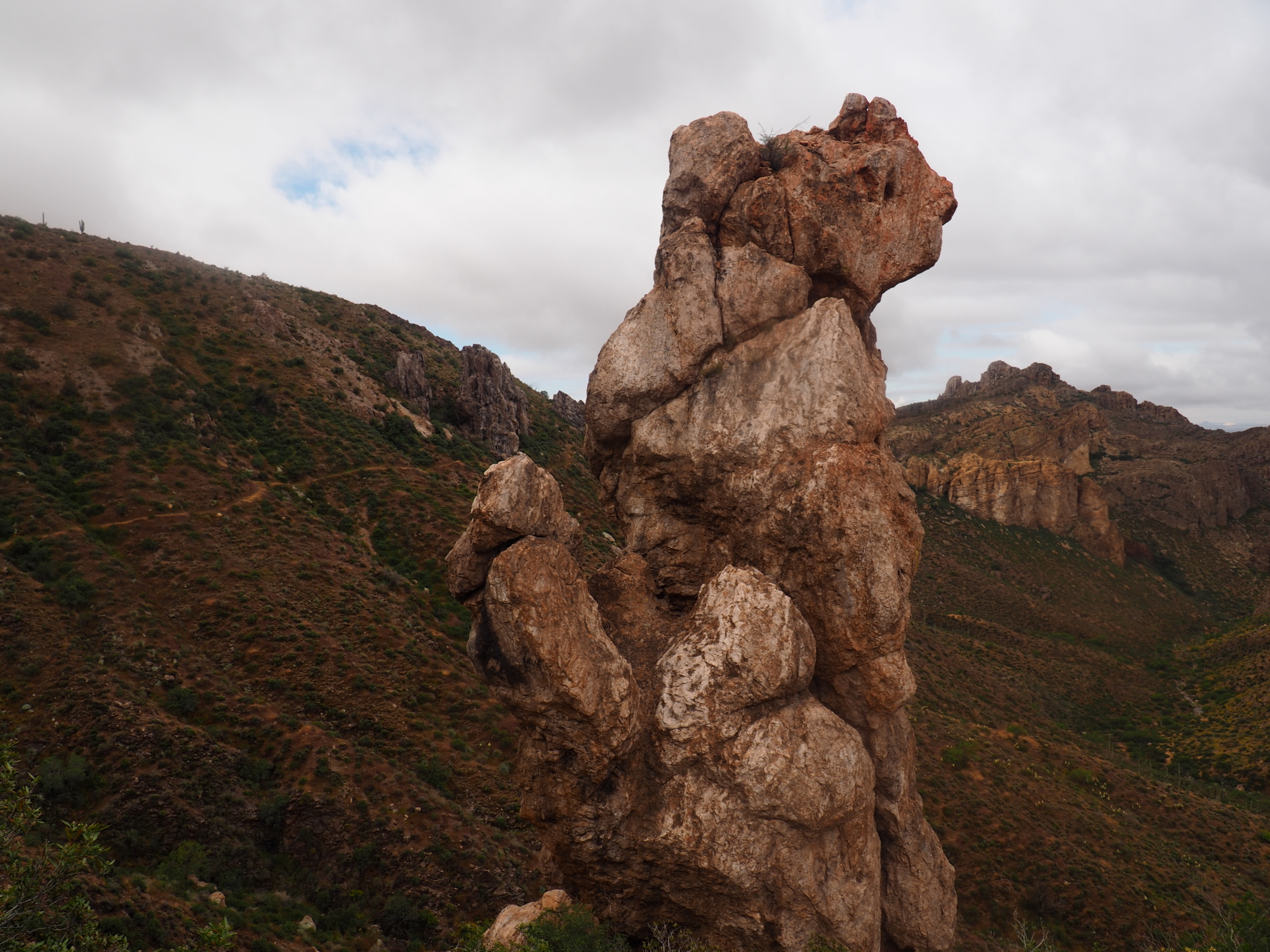
The feeling, sight and smell changed immediately, it was great. The Superstition Wilderness is remarkable.
It was downhill 1.1 miles to the Rogers Trough trailhead, where we would split for the day as they would go on their side trip.
I arrived there about 8:05, filtered water from the creek and waited for them.
I had been using my Steripen since yesterday, as the water from the creeks was clear. The Steripen has a constant purifying time, 90 seconds per liter. The performance never degrades, and it kills viruses. It is still number one for me.
The girls arrived at 8:10. We sat until 8:30 and then I left. We would meet at Roosevelt Lake tomorrow.
My destination was Reavis Ranch, 7 miles away. There was an immediate 1000 feet climb over 2 miles, this one also with no switchbacks. Sigh!
After the climb I entered a beautiful Alpine meadow, it was very large and stunning. I could understand why Reavis had chosen to live here.
Water was plentiful on this stretch.
I reached Reavis Ranch at 12:10 and spent a couple minutes photographing the ruins, and then I went to Reavis creek, right next to the ranch, and had lunch there and filtered water.
I hit the trail again at 1, and immediately encountered a 500 feet climb in .4 miles, with no switchbacks, just a straight climb.
The trail was also rocky, making the progress slower.
There were three elevation changes between 300 and 400 feet, again with no switchbacks. The trail was rocky and with big boulders.
Then followed an 800 feet descent, it was steep, rocky and slow going. I was tired. There was a small flat area followed by an 800 feet ascent. I resolved to camp and make the ascent in the morning.
But there was no place to camp in the flat area, so I continued for another half mile and found a spot right before a wash, it was flat, had soft dirt and was surrounded on three sides by trees. It was 5:30.
I had a cold dinner and went to bed around 7:30.
I had done 14.7 miles.
Easter Sunday, April 21
I made a cold breakfast of oatmeal, powdered milk and cherries and cranberries, and a hot Earl Grey. Then I hit the trail at 6:30.
It was a tough 800 foot climb, and not the last climb, but I was rested.
The trail was difficult. It was rocky, it was overgrown. My next water source was 7 miles ahead, and I had two liters on me. But it was a cool morning.
There were a lot of little climbs between the two big ones and it was not a breeze.
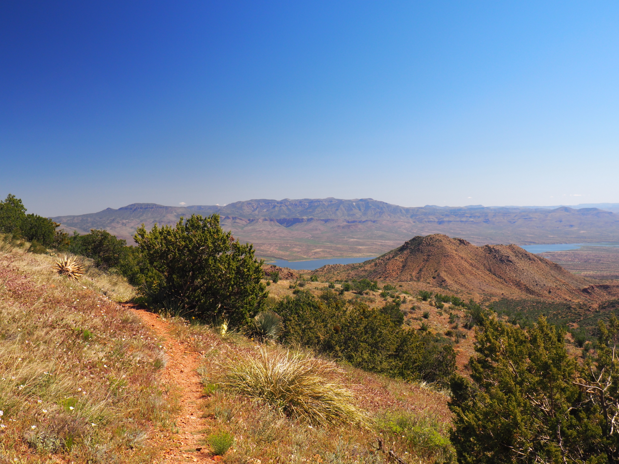
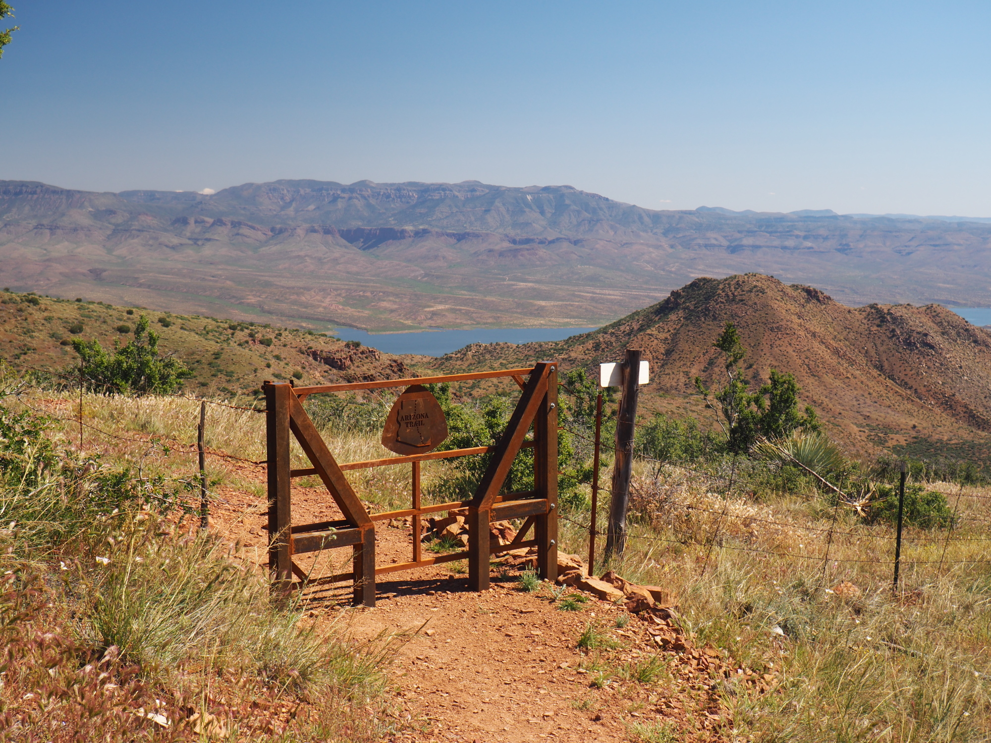
I saw great views of Roosevelt Lake from high above.
I made it to the stock tank around noon. It was the last definite source before Cottonwood spring, which I was not confident in.
I decided to get a liter at the stock tank but filter it only if Cottonwood Spring was dry.
I went to the edge of the tank, which had brown water, and squatted and strained water over a cotton cloth on top of my BeFree.
I have low blood pressure. Whenever I squat for more than five seconds and stand up real fast I get a head rush, 100%. I know that and always stand up slowly after squatting.
But this time I didn't stand up slowly, and I got a nasty head rush. I blacked out and was awakened by sounds of splashing, and I found myself staggering in the pond, which I fell into to my knees. I caught myself with my right arm.
Everything from the knees down was soaked with muddy water. I had my camera around my neck; thank God it did not fall into the water.
I sat for a couple of minutes to recover, and then I filled my BeFree again. I then took off my shoes and socks and rung the water from my socks.
It was a sobering experience and it was my fault.
After about 10 minutes I started again.
I reached Cottonwood Spring one hour later. It was only 1.8 miles away. It had clear water, so I dumped the water from the stock pond and used my Steripen to purify water from the spring.
The trail followed Cottonwood creek and it crossed it a million times. It was difficult, with large boulders. I did not enjoy it at all.
The trail finally left the creek and joined a dirt road which went 3.1 miles to the Roosevelt lake marina.
It was a steep descent and the road was rocky and the footing was loose.
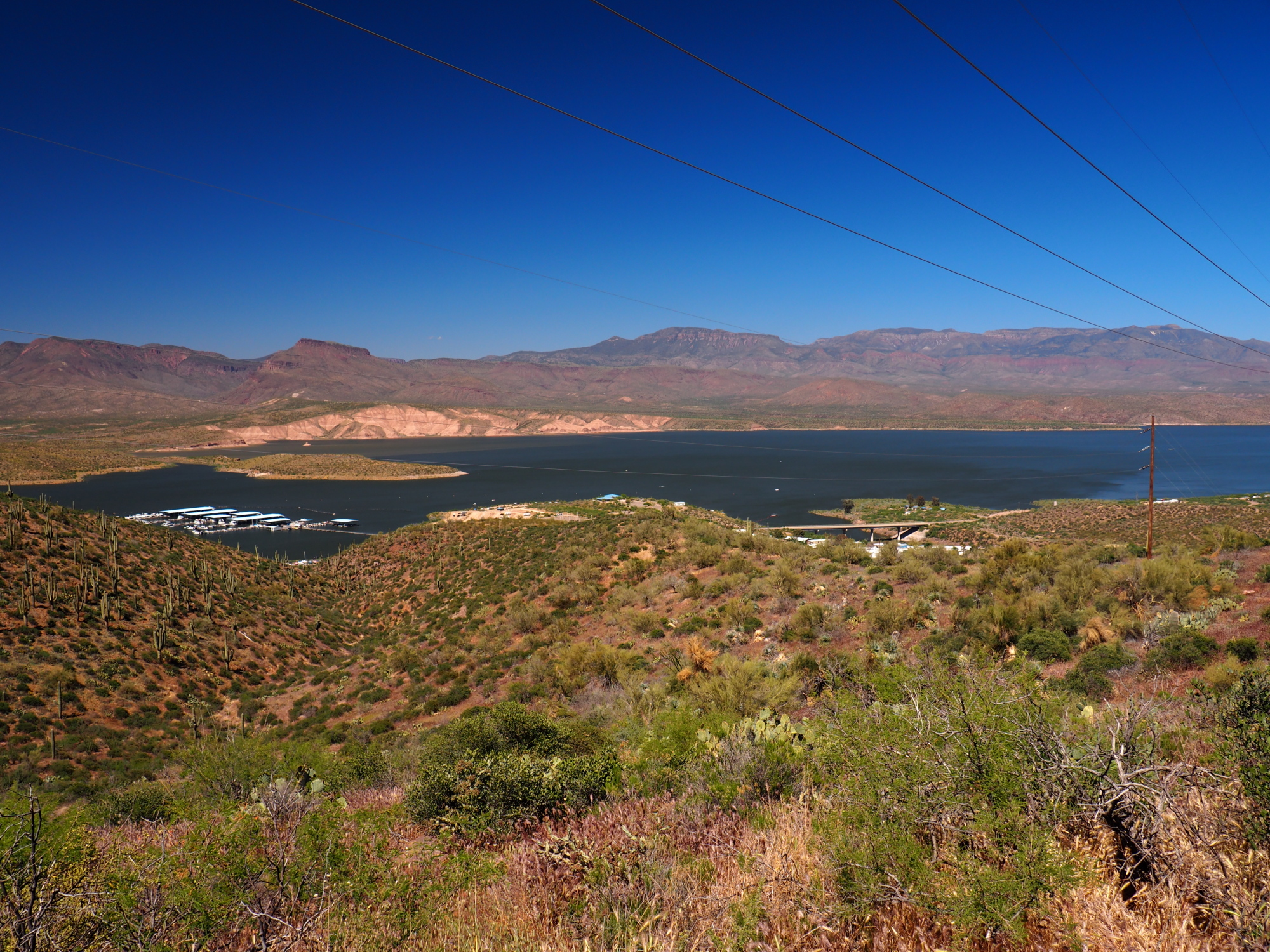
I made it to Roosevelt Lake at 3. It was a 13.5 mile hike, one of the toughest I had done on the AZT.
I went to the store at the marina and had a Gatorade. Then I ordered a hamburger.
I paid for a camp spot and went and pitched my tent, only 15 feet from the shore. Then I went swimming and laundered my clothes in the lake. I hung them on the bushes next to my tent to dry.
I went to the Tonto National Forest visitor center for the view, pulled my phone out of my pocket and snapped a picture. Then I went back to my tent, only to discover that I had lost my driver's license, which was in the same pocket as my phone. I went back to the visitor center and found it on the concrete walkway.
I returned to my tent and was ready to fall asleep at 7:30, but it is a popular spot, with many RVs. The one 50 feet away from me had his generator running, and I could not sleep. I knew I had to wait until 10 PM.
I made use of the time by doing some star photography. I got great pictures of Orion.
He turned off his generator at 10. I fell asleep fast. At about 4 AM, while I was in the midst of a great sleep, enjoying a wonderful dream, I was snapped out of it by a coyote which was 10 feet away from me at the lake shore. He yakked for about 2 minutes then stopped.
I went back to sleep.
Monday, April 22
Capitan, Honeydew and Cheetah arrived around noon. We spent the day at the Marina store and restaurant, whose staff are the rudest and most hostile people I have ever encountered. We met 4 other AZT hikers who arrived but did not stay the night.
Tuesday, April 23
I woke up around 5:30. Honeydew and Cheetah had left already. Capitan had to stay until 8 because yesterday she left her power pack in the U.S. Forest service office to charge and it closed before she could retrieve it.
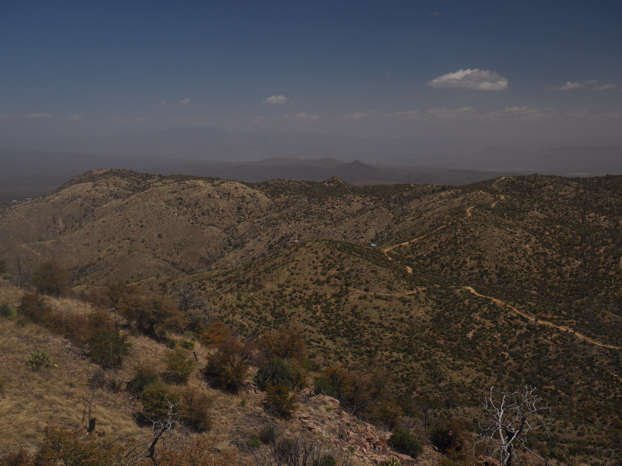
I hit the trail at 6:55. My right foot began to hurt immediately. The trail went up into the hills and around a couple of drainages, pointlessly and needlessly. Sometimes a trail does not make sense, and this segment, from Roosevelt Lake Marina to Roosevelt Bridge, was an example of that. There were no compelling views and two needless ascents and descents. It was 1.5 miles of bland hiking. The walk on Route 188 from the Marina to Roosevelt Bridge was only a half mile and hugged the lake. That would have been a much more enjoyable route.
As I made my way to the bridge the pain in my right foot intensified. It was very uncomfortable.
I reached the bridge at about 8:10 and walked across it, as I had to, to reach the trail, which continued on the other side of the reservoir. I got there at 8:25, and stopped at a large pullout on the south side of 188, a vista point. My foot was hurting badly. I took off my shoes and allowed it to rest for about 30 minutes. Then I put my shoes on and walked on it to feel it out, and it still hurt badly. So I let it rest for about 50 minutes and tried walking on it again, but it still hurt the same.
Capitan arrived around 10 and I told her that I had to stop because the pain in my foot was very bad. Had I continued the next exit point, Sunflower, would have been 41 miles away, and I did not want to risk it.
Capitan understood and went on ahead. I tried to hitch-a-ride in the next two hours without success. Finally, I called a trail angel who lives in Apache Junction and asked him to bring me to Phoenix, and he said yes.
I walked back to the Marina on 188, it only took 20 minutes. I got there around 12:30. The trail angel, Henry Kirk, would come at 4, so I had plenty of time.
I went to the restaurant for lunch. I set my backpack on a chair at my table. The bartender told me I could not do that, it had to be set outside. As I said, I have never experienced such hostility before.
When Henry and his wife arrived at 4 we bought a few cold drinks from the Marina store. Right after we paid for them at the register Henry opened his Coke, and the woman working the register immediately snapped at him and told him he could not drink that in the store. It was unbelievable.
Henry had picked up another hiker, who had also injured her foot, and the 4 of us made for Phoenix. We stopped at a very nice Mexican restaurant on the outskirts of Phoenix and I bought dinner for all of us, to show my appreciation for these wonderful trail angels. Henry and his wife were elderly and super nice.
They dropped both of us off at Sky Harbor airport. The other hiker had a flight to Canada, where she was from, and I got an Uber to bring me to my cousin's house in Glendale.
Tuesday, April 30
I spent the last 7 days with my family. My cousin's wedding was on Friday, April 26. My mom and two younger sisters came for the wedding from Chicago. My cousin's sisters and parents came from London, and other cousins came from Sweden. It was a lot of fun. It made me appreciate family and its importance, especially since I had been hiking essentially alone for the past month.
I needed a ride from Phoenix to Pine, where Capitan, Honeydew and Cheetah were taking a zero today. The day before I posted a message on the AZT Class of 2019 Facebook page, asking if anyone could give me a ride. A woman answered yes, as she was heading from Phoenix to Wyoming. I met her in Fountain Hills and we set out for Pine around 1. I arrived in Pine just before 3. I gave her $20 dollars for the ride.
The girls were staying at a winery owned by a trail angel. I met them there and gave them a treat, a piece of very delicious baklava for each from my cousin's wedding.
They also gave me a treat, as it was my birthday.
Capitan and I walked to the Tavern for dinner around 5:30, where I had the most delicious hamburger I have ever had. She gave me a birthday gift, a Western novel called Hondo. I very much appreciated the thought and I thanked her very much. We then returned to our sleeping quarters, a large metal garage converted into a dorm. It had a shower and a wood burning stove.
The stove had been burning all day and it was very warm in there. I asked the girls not to feed the fire anymore and they agreed. But it was still too warm for me, and I had to step outside a couple of times in the course of the night to cool off. But I did finally fall asleep.
Wednesday, May 1
We all woke up at 5:30. I was ready to go in a couple of minutes, as I had not unpacked anything the night before. I had bought a breakfast burrito, yogurt and an orange juice the night before and ate those while the girls packed.
Honeydew could not find her stove and spent 20 minutes looking for it but to no avail. She ordered a new one from Amazon and had it shipped to Mormon Lake, our next stop.
We resolved to camp at General Springs Canyon tonight, on the Mogollon Rim. It would be our longest day so far at about 22.5 miles.
Ray, the owner of the winery, drove us to where the AZT intersects Beeline Highway (87). We said our goodbyes and hit the trail, first Cheetah, then Honeydew a few minutes later. Capitan and I waited a few minutes then hit the trail at 6:07.
The trail was a very nice and smooth single track and relatively flat, with minor elevation changes until the very end, where we would climb up to the Mogollon Rim.
We arrived at the trail head about 10 minutes later and Capitan went to have a coffee with a local who was there with his RV. I continued.
I caught up with Honeydew about thirty minutes later and we leapfrogged a couple of times, and then she passed me and continued ahead.
I had terrific views looking back and down at Pine, and starting about 7 miles later terrific views of the Mogollon Rim to my the left and front.
Water was plentiful and I only carried two liters, as it was in the upper 50s in the morning.
I made good progress, keeping a steady pace of 2 miles per hour. The trail went around several drainages and hills, but still the elevation changes were trivial, 200 feet or less. But it had been steadily climbing gently since the very beginning.
At 10:30 I arrived at a creek and found Honeydew and Cheetah sitting there eating. I filtered a liter and sat for a few minutes. Vaz, an AZT hiker, arrived a few minutes later, followed by Capitan. We sat for about 45 minutes. A married couple arrived while we were sitting there. We chatted for a few minutes and they left. Vaz departed a few minutes later, followed by Capitan.
The next water source was the headwaters of the Verde River, at the base of the big climb to the Mogollon Rim, at mile 19 of this stretch. It was about 11 miles ahead. I made it there by 4:50. I saw Capitan standing on the bridge over the river talking to Vaz.
The husband and wife were camping there for the night, as was Vaz.
I had two liters of water so I did not filter any. Capitan went ahead and I followed about 5 minutes later. About 30 seconds after I left I heard the voices of Cheetah and Honeydew. I looked back and saw them standing on the bridge.
The big climb had began, 1000 feet over two miles. The trail met an old dirt road about half mile later and followed it for about one mile as it climbed up to the Mogollon Rim. It was not bad, but I knew the meat of the climb was still ahead.
About half mile from the Rim the trail left the road, which I could have followed up to the Rim, and began seriously climbing, 500 feet over half a mile. It was very rocky, with some boulder hopping. But I had my second wind and did not feel tired.
Just past the base of this last climb there was a side trail to an old railroad tunnel and I saw Capitan's trekking pole at the intersection. She had left it there to indicate she had gone to the tunnel. I was focused on the climb and proceeded forward.
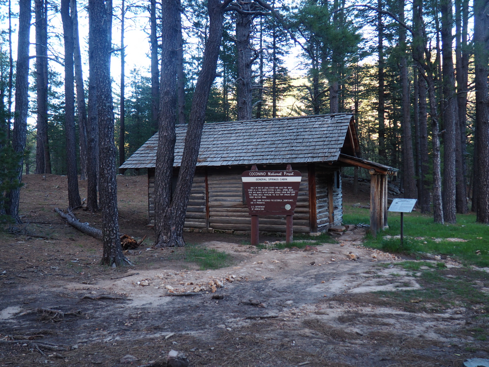
I made it to the top at 6:04 and rested for a couple of minutes, then continued on for about half a mile to General Springs Cabin. Then I went ahead about a quarter of a mile to the trailhead. I waited for Capitan for a few minutes. It was cold on the Rim so I put on my down jacket. While doing that Capitan arrived.
At about 6:20 we set out for General Springs Canyon, about 1 mile ahead, where there were nice campsites next to the creek.
We arrived at the first intersection of the AZT with the creek at about 6:45 but the camping sites were not good, so we continued ahead about another half a mile, where we found a nice campsite with a fire ring. It was about 7. Capitan wondered if Cheetah and Honeydew would make it.
Capitan started building a fire, but it was difficult as everything was damp. While she was doing that I made dinner and Cheetah and Honeydew arrived. Capitan managed to start the fire after about 20 minutes but it did not last long.
We all had dinner then we pitched our tents. It was already cold, there was fog coming from my breath. I knew it would be a cold night. I put on two top layers and two bottom layers and my socks, as well as a fleece cap. I had bought a sleeping bag liner for this part of the AZT from the Rim to the end, because it would be between 7000 and 9000 feet elevation and I knew it would be colder. The liner added about 5 degrees of warmth to my 30 degree quilt. Would it be enough?
We had done 22.4 miles for the day. It was my longest so far.
Thursday, May 2
I woke up around 5:30. I did not sleep well. It was cold, and I did not fall into the deep R.E.M. sleep all night. I just dozed off and kept waking up.
Cheetah was almost packed. She hit the trail about 5:45. Capitan followed about ten minutes later. I made breakfast then quickly packed up. I had to filter 3 liters of water for the next stretch. It was cold and my fingers got wet filtering the water. But I was using my Steripen so it was quick, 90 seconds per liter. I had to wear my gloves for the next 15 minutes to warm up my hands.
I hit the trail at 6:45, about ten minutes after Honeydew left. It was easy going on the Rim, as it was mostly flat, with only a couple of climbs coming up. There were a couple of water sources ahead but I didn't need them, as it was cool and somewhat shady in the Coconino National Forest. It smelled nice with the scent of Pine.
But all that I could think about was going home.
My destination was East Clear creek, 7 miles ahead. As I made for it the thought of going home overwhelmed me. I knew the AZT would intersect Beeline Highway 13.7 miles ahead, and there I could hitch back to Phoenix.
I made it to East Clear creek by 10. It was a 500 feet descent to the creek, where I found Capitan and Honeydew sitting on a gravel bar in the middle of the creek, having lunch. I joined them.
From the beginning Capitan had a Tyvek sheet which she used as a ground sheet and for other things. It was such a great idea that I brought mine, which I had with me in my car in Phoenix along with all my other gear. I spread the sheet on the gravel and sat on it and made lunch.
Then I made the decision to stop. I told Capitan and Honeydew that I was ending my hike at Beeline Highway. They asked me why, and I am not sure I knew the reason, but I knew I wanted to stop. They were very saddened by it, as was I, as we three had become a family and we enjoyed hiking with each other.
We said our goodbyes, hugged each other, and they left. I remained for about 20 minutes then hit the trail.
It was an immediate 600 foot climb in .8 miles out of the creek, but I did not feel it. The highway was about 7 miles ahead.
I felt comfortable with my decision, but I was thinking about why I made it. The preliminary answer was the week I spent in Phoenix for the wedding, with my mother and sisters and my cousins, had changed me. It had brought focus to the importance of being with your loved ones. While I enjoy being alone, and do it often on short trips during the year, I felt that one month was enough for me.
I looked at the map to see if there was a forest road I could use to reach the highway faster, and there was. I hit Forest road 751 2.5 miles later. From there it was 4.5 miles on the trail to Beeline Highway, but going west on 751 was only 1.5 miles. So I took the road. Several cars passed me in both directions. About a mile later I got a hitch to the Blue Ridge Ranger station on Beeline Highway. It was 12:30.
I did not have mobile coverage, so the U.S. Forest service ranger, Amelia, let me use the landline to call for a ride. But none of the trail angels could come and get me. She overheard me and asked me where I was going, I told her I had to get to Glendale. She said she and her husband were going to Sun City, only a few miles from Glendale, at 5 and she would be happy to give me a ride. I accepted and thanked her profusely.
It was about 1 and she would not leave work until 4, so I sat at the picnic table in front of the office and made lunch, then I spread my Tyvek sheet on the ground and lay on it for a couple of hours.
At about 4:15 we left for Pine, where she lived. I met her husband Dennis, a very nice guy. At around 5 we drove for Glendale.
Amelia and Dennis are extremely nice people, very genuine and sincere and I liked them very much. We had great conversation during the two hour drive. They drove me to my cousin's house and told me that if I was in Pine again I could stay with them. I said I would treat them to dinner the next time I was there. They went for dinner at their favorite Mexican restaurant, Mextica, only a half mile from my cousin's house.
I had done 380 miles on the AZT and thus my adventure ended.
But not quite...
Saturday, May 4
Had I continued the hike our next stop would have been Mormon Lake, where I had sent a resupply box. The girls were arriving there on Saturday morning, so I decided to meet them there and also claim my resupply box.
I left Glendale at 9 and made it to Mormon Lake at 11:10. I went to the post office and got my box. I sat at the Saloon and waited for the girls. Capitan arrived at about 11:30, followed by Honeydew at about 11:45.
Honeydew went to the post office to get her stove, which at first could not be found, but she got it. We met Cheetah, who was ending her hike at Mormon Lake, as planned, and her friends, who had picked her up the day before. They were going to drive to Sedona and to Prescott, where they lived.
Vaz was also there and he was also ending his hike, as planned.
Cheetah and her friends left at about 12:30. We went to the lodge where there was a BBQ buffet and had a great lunch.
I gave all my food to Capitan because she had not sent herself a resupply box. I also brought Capitan and Honeydew a treat. I brought 5 packets of Land-O-Lakes cocoa for Capitan and a box of Starbucks Via instant coffee for Honeydew.
We sat at the restaurant until 4 then moved to the Saloon. It was very difficult to pull myself away, but I finally did and hit the road at 4:30. I left with profound sadness.
But we talked about doing another hike together, we three, and I recommended the Tahoe Rim trail.
I finally left for Chicago. I drove to Grant, New Mexico, where I spent the night. The next day I spent the night in Joplin, Missouri, and on Monday arrived in Chicago at 5, just in time for rush hour!
It is an adjustment from walking 15-20 miles a day to sitting at home with nothing to do.
I will return to work on June 3. I am not sure I am looking forward to it. I had read that doing a thru-hike changes you. Now I know it is true. Even though I only did 380 miles, it has changed me. I feel it. I am processing it, trying to understand the change, but it has changed me.